WILLISTOWN CONSERVATION TRUST

  • Facebook
  • Instagram
  • LinkedIn
  • YouTube
DONATE
  • About
    • HOW WE WORK
    • WHERE WE WORK
    • OUR STAFF AND TRUSTEES
    • JOBS & INTERNSHIPS
    • VOLUNTEER
    • RUSHTON CONSERVATION CENTER
    • STRATEGIC PLAN
    • DIVERSITY, EQUITY & INCLUSION STATEMENT
    • FAQs
  • LATEST
    • BLOG
    • IN THE NEWS
    • PUBLICATIONS
    • PHOTOS
  • PROGRAMS
    • BIRD CONSERVATION
    • COMMUNITY FARM
    • EDUCATION
    • LAND PROTECTION
    • STEWARDSHIP
    • WATERSHED PROTECTION
  • NATURE PRESERVES
    • ASHBRIDGE PRESERVE
    • HARTMAN MEADOW
    • KESTREL HILL PRESERVE
    • KIRKWOOD PRESERVE
    • RUSHTON WOODS PRESERVE
  • EVENTS
    • EVENT CALENDAR
    • BARNS & BBQ
    • RUN-A-MUCK
    • WILDFLOWER WEEK
    • ECOCENTRIC EXPERIENCE
    • RUSHTON NATURE KEEPERS (RNK)
    • ACCESS Program
  • Support
    • WAYS TO GIVE
    • SPONSOR THE TRUST
    • CORPORATE PARTNERSHIP PROGRAM
    • JOIN THE SYCAMORE SOCIETY
    • LEGACY SOCIETY & PLANNED GIVING
    • DELCO Gives 2025
  • CAMPAIGN FOR KESTREL HILL PRESERVE

The Tale of Two Streams

June 25, 2022 By Anna Willig

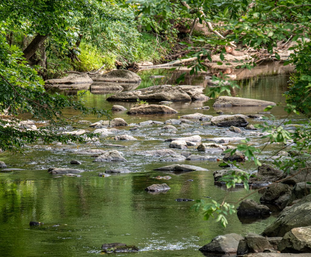
Every four weeks, the Watershed Protection Program heads over to East Goshen to visit two branches of Ridley Creek near the Goshenville Blacksmith Shop. We trudge down the road to our first site, RC1, which lies in the main stem of Ridley Creek. We hop in the creek, take measurements, collect samples, and then we walk about 150 feet to our next site, WBRC1, West Branch Ridley Creek, where we do it all over again. Even though these two sample sites are right next to each other, WBRC1 is in a completely different creek. Just downstream from these two sample sites, the West Branch merges into Ridley Creek, and the waters from the sample sites flow together as one.

Ridley Creek

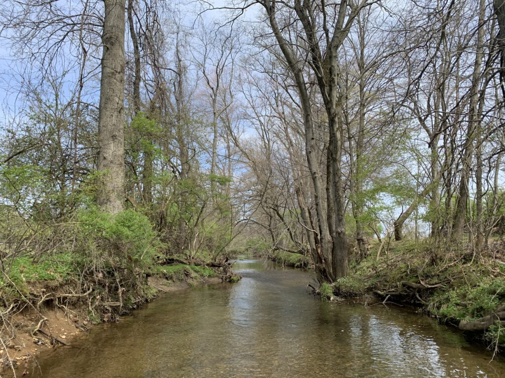
In many ways, these two streams are identical. The amount of water flowing through them is nearly the same. Also similar in size is the size of land they drain. Their banks are lined by both trees and shrubs, with a few patches of clearing. The stream beds are rocky along with some sand and mud near the banks. Given all of these similarities, it would be easy to imagine that the water quality is similar at these two sites, as well.

image preview
West Branch Ridley Creek

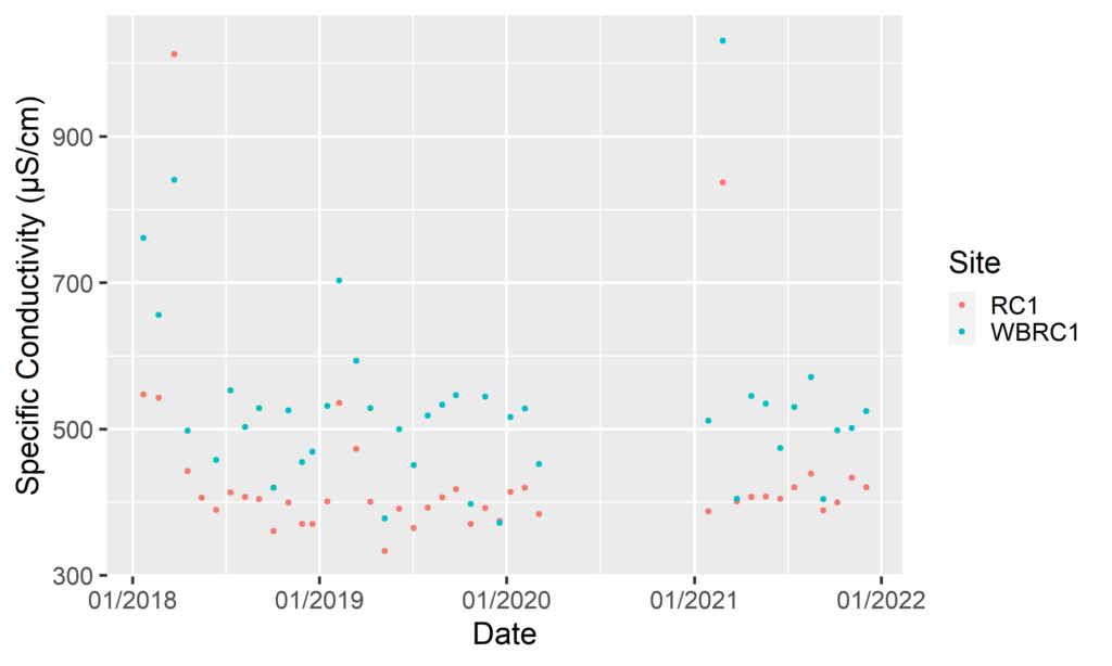
However, as the Watershed Protection Team discovered, once we started looking at the water chemistry, we found that the two streams are quite different. Immediately, we noticed differences in specific conductivity. Specific conductivity measures the ease at which electricity can move through water, and pure water is a terrible conductor, meaning it has low specific conductivity. So when we find that specific conductivity is high in water, then that tells us that there are pollutants present. Comparing WBRC1 and RC1, we found that the specific conductivity is much higher in WBRC1 than RC1, meaning the water quality is much lower in WBRC1. However, specific conductivity cannot tell us which pollutants are in the water–it can only indicate that there are pollutants.  

Specific Conductivity Data for RC1 and WBRC1

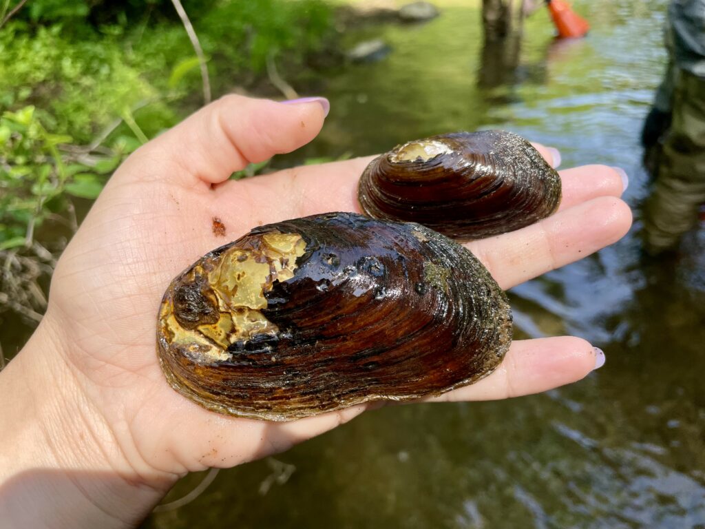
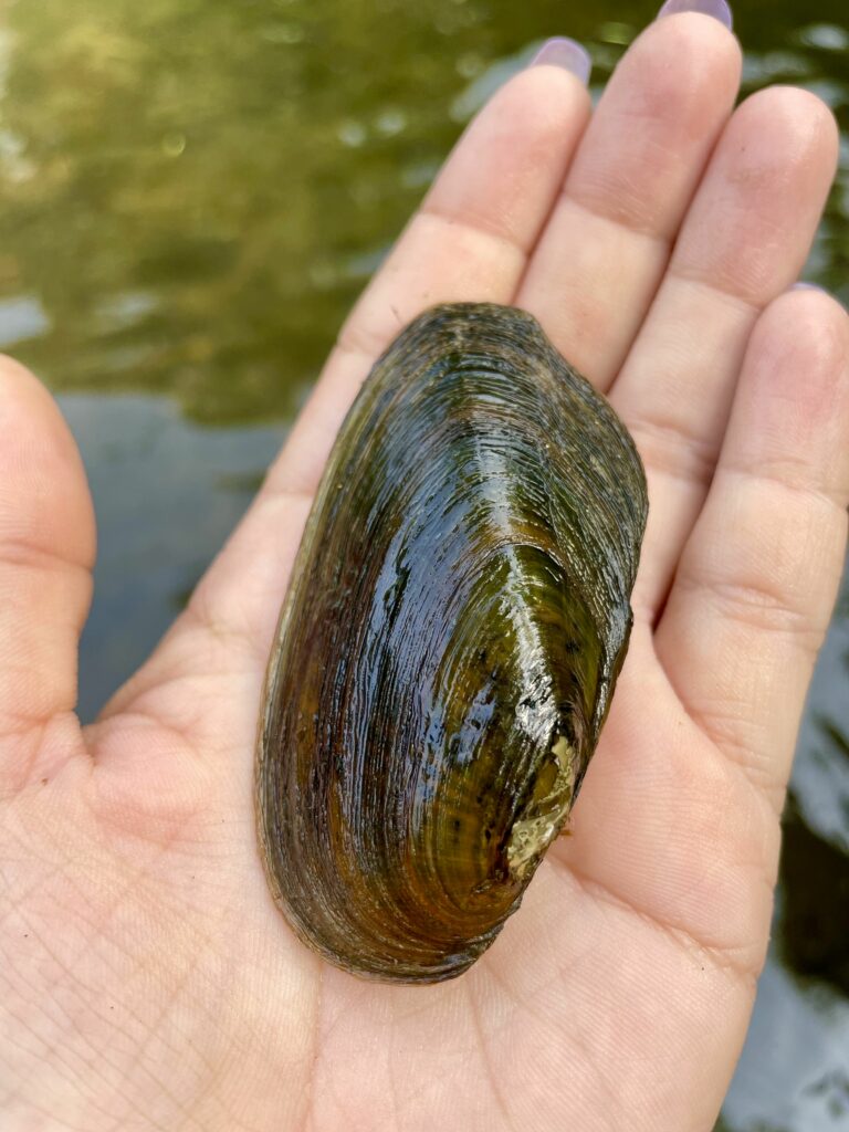
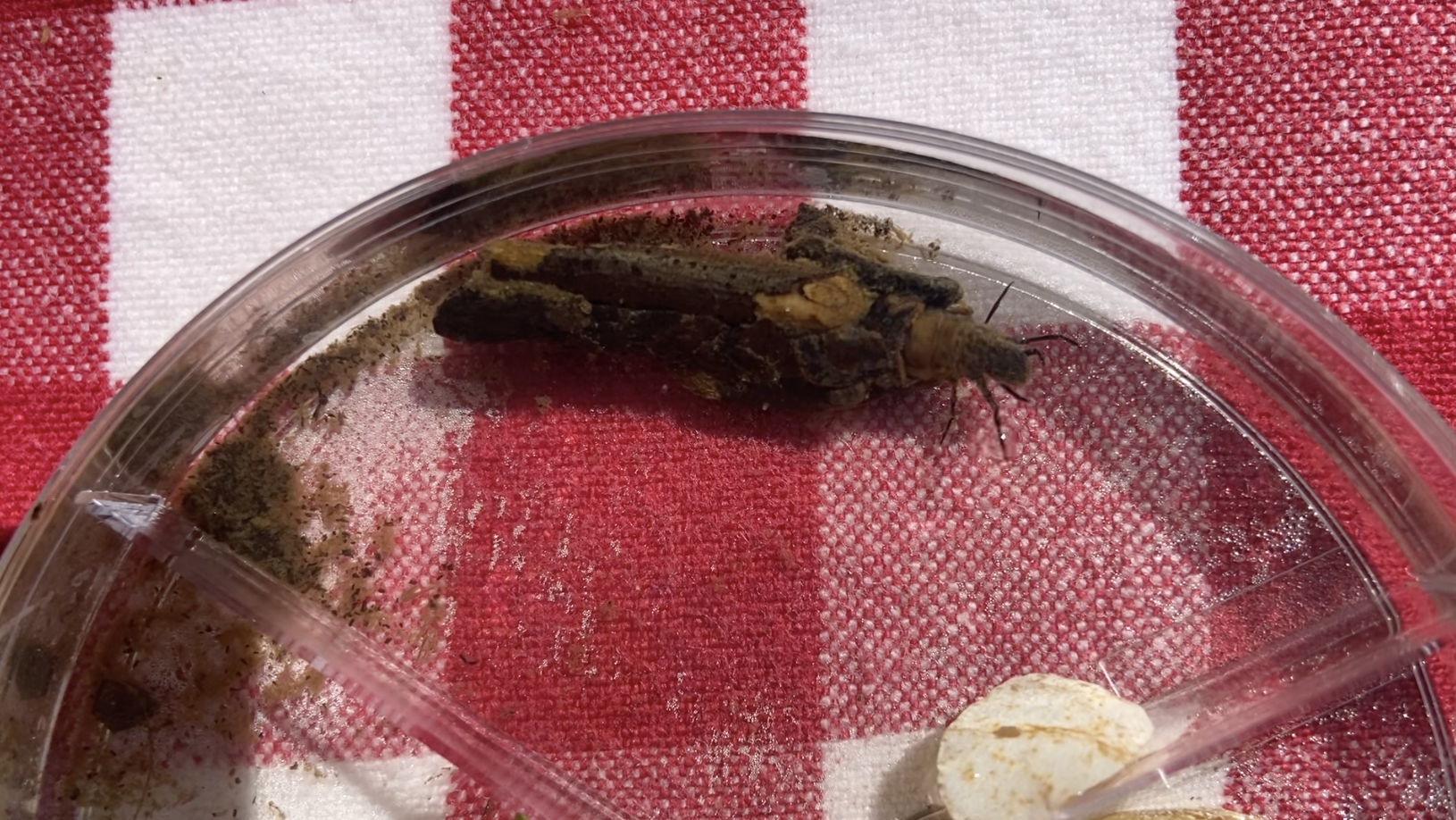
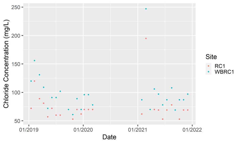
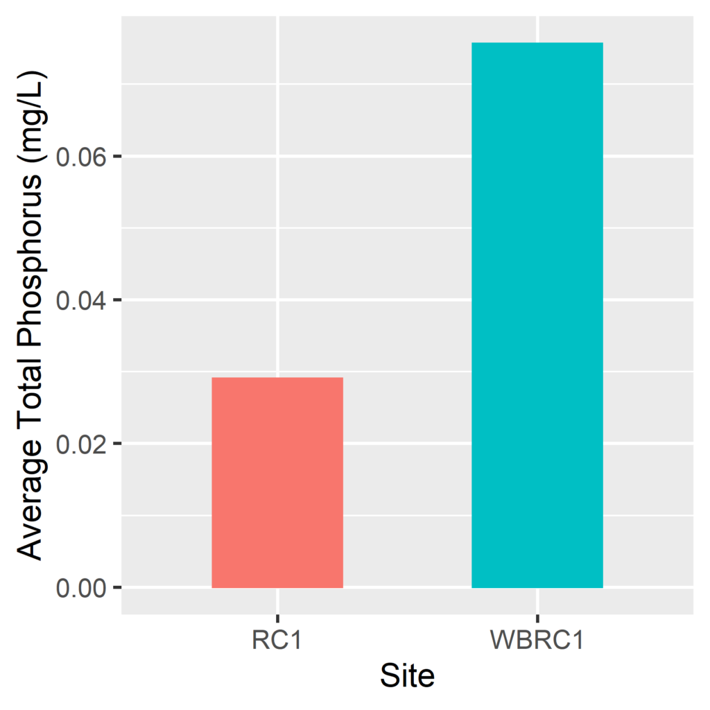
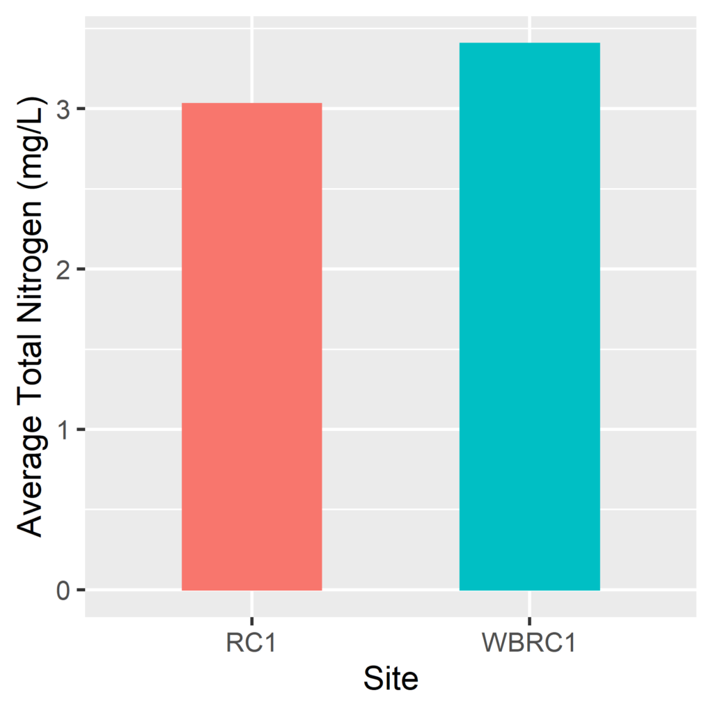
Looking deeper into the chemistry, we found that WBRC1 contains higher concentrations of chlorides, nitrogen, and phosphorus, all of which increase specific conductivity. So where are they coming from? For chlorides, the answer is road salts. After road salts are applied in winter, they runoff into streams and groundwaters, where they can persist throughout the year, leading to higher concentrations of chlorides year round. For nitrogen and phosphorus, the answer is a little more complicated. They can come from a few different sources, most commonly fertilizers, leaky septic and sewer systems, and animal waste. Elevated concentrations of chlorides, nitrogen, and phosphorus are concerning because these pollutants can threaten the survival of sensitive stream organisms, such as mussels, trout, and stream insects. 

RC1 and WBRC1 Chloride Data

However, this poses more questions: why are there higher concentrations of salts and nutrients at WBRC1? How could water chemistry at two sites only 150 feet apart from each other be so different? To understand where these contaminants are coming from, we needed to look at what is going on in the land upstream of each sample site. And what we found is a difference in impervious surfaces.

Phosphorus Bar Graph
Nitrogen Bar Graph

Impervious surfaces are any surfaces that water cannot directly pass through, such as roads, sidewalks, parking lots, driveways, and buildings. These surfaces have several direct and indirect impacts on water quality. Many impervious surfaces are treated with road salt in the winter, and any rain or snow that hits these surfaces will carry that salt into the stream, increasing chloride concentrations. Impervious surfaces also reflect human activity in an area. Generally, the more impervious surfaces in an area, the more humans, and with more humans comes more fertilizer applications on lawns and gardens and more septic and sewer systems, all of which can flow into streams. As a result, there is a strong relationship between the amount of impervious surface cover and the pollutants that drain into a stream system.

We found that of the land that drains into WBRC1, 20% of that area is covered by impervious surfaces, as compared with RC1, where only 14% of the area is covered by impervious surfaces. While 6% may seem like a small difference, it is large enough to account for the difference in water quality of these two streams. This tells us that for Ridley Creek to maintain its health and water quality, we need to strive to stay below 20% impervious surfaces, and maybe even less than that. 

image preview
Catchments draining into West Branch Ridley Creek (WBRC1) and main stem Ridley Creek (RC1) sampling sites. Note the dense impervious surface cover in the WBRC1 catchment compared to the RC1 catchment.

The story of these two streams can be a hopeful one, and there are many lessons to be learned. If we can keep the amount of impervious surfaces down, we can protect water quality, even at an incredibly local scale. The more land we can protect as open space, the better the water quality in our streams and rivers. 

In addition to protecting land, we as individuals can also reduce the impact that impervious surfaces have on streams by doing the following:

  1. Limiting the amount of road salt used in the winter or sweeping up road salt after storms pass. This is a great way to reduce the amount of salt entering streams. 
  2. Reducing fertilizer use and avoiding applying fertilizers before rainstorms.
  3. Planting rain gardens alongside roads and driveways to help collect and filter stormwater, further reducing the amount of salts and nutrients entering streams. Native flowers, shrubs, and trees are great at absorbing excess nutrients and salts before they enter streams, and planting more of these plants will go a long way towards improving water quality.  
  4. Finding more tips here: Healthy Streams Start with Healthy Landscapes.

No matter how far away you are from a stream, any action you can take will make a difference.  

— By Watershed Conservation Associate Anna Willig

Sources:

Baker, M. E., Schley, M. L., & Sexton, J. O. (2019). Impacts of Expanding Impervious Surface on Specific Conductance in Urbanizing Streams. Water Resources Research, 55(8), 6482–6498. https://doi.org/10.1029/2019WR025014

Morse, C. C., Huryn, A. D., & Cronan, C. (2003). Impervious Surface Area as a Predictor of the Effects of Urbanization on Stream Insect Communities in Maine, U.S.A. Environmental Monitoring and Assessment, 89(1), 95–127. https://doi.org/10.1023/A:1025821622411

Filed Under: Nature, Science, Watershed

A Cycle of Give and Take

June 24, 2022 By Watershed Protection Team

By Watershed Protection Program Co-Op Sarah Busby

Within our streams, there are many players that work to create a functioning, thriving ecosystem. From the tall trees that hang overhead at the bank’s edge, providing cooling shade and abundant habitat, to charismatic animals like the beaver that literally shape the movement of the stream, some species play a more visible role than others. However, there are plenty more individuals hard at work behind the scenes, — or rather, below the surface of the stream. One such character is the freshwater mussel. Sometimes mistaken for a stone, this unassuming animal quietly resides at the bottom of our streams, often going unnoticed. While an individual mussel may be overlooked, their dramatic impact on a stream is impossible to miss when they work together.

One of many Elliptio complanata mussels found in our very own Crum Creek during a recent mussel survey. Photo by Sarah Busby

Freshwater mussels begin their life in a curious fashion, highly dependent on the fish in their communities. During reproduction, female mussels release packets of larval mussels, or glochidia, carefully timed with the encounter of a suitable host fish. After release, the larval mussels must attach to the gills of their host to survive. Once the larvae have secured a ride, they will travel with their host until they grow big enough to go off on their own, which may take up to a few weeks. When ready to depart, the mussels drop off and settle down into the riverbed. Host fish not only provide a safe haven for the larval mussels to develop in, but also allow for them to disperse much greater distances than freshwater mussels could ever go on their own. While glochidia do not cause harm to their host in most cases, the obligate parasite owes much to the hosts they grow up in. Though freshwater mussels are quick to give back to their neighbors once they come into adulthood.

Freshwater mussels are constantly filtering through water to breathe and feed. Typically, they sit partially buried into the substrate, siphoning in water. As water flows through their gills, they filter out bacteria, algae, phytoplankton, detritus, and other small organic particles to feed on. In this process, they also filter out pollutants from the water, accumulating the contaminants into their own bodies.

The filter-feeding activities of mussel populations greatly improves the water quality of the bodies of water they inhabit. This is beneficial to the rest of their local community. The fecal pellets they expel provide food for other invertebrates, and the mussels themselves are consumed by fish, birds, and mammals alike. Additionally, their shells provide shelter and habitat for aquatic invertebrates like caddisflies, midges, and other insects that fish rely on for sources of food. Much like the fish who sheltered them in their vulnerable state, an adult mussel provides for its community throughout its entire lifetime of up to a century, and even beyond when only its shell remains.

Mussel by Sarah Busby

Freshwater mussels have a long history of providing not only for their aquatic communities, but for humans as well. These mussels were a major food source for many prehistoric [1] and pre-colonial people in North America. Multiple Native American tribes have mussel harvests that date back to over 10,000 years ago. The shells were used for creating tools and jewelry. Before the invention of plastic, buttons were also made from the shells of mussels. The mentioned uses were in addition to the ecological service mussels provide by improving the quality of our water sources. While the cultural use of mussels has shifted over time, this critical service upholds its relevance.

Now in modern times, freshwater mussels are more vulnerable than ever before. From habitat degradation, pollution and impaired water quality, mussels face threats on multiple fronts — many of which are human imposed. As many native host fish species decline, the mussels follow close behind.

Currently, freshwater mussels are considered the most endangered group of organisms in [2] the country. It is our turn to provide for the mussels and the communities that come with them. Protecting the mussels means protecting our rivers and streams. Current efforts are being made to reintroduce [3] freshwater mussels into our streams and foster their growth through research and restoration. But success of these efforts is brought to fruition through community support. It starts with appreciating the role mussels play in a thriving ecosystem and follows by embracing our own part in it.[4] 

— By Watershed Protection Program Co-Op Sarah Busby

Sources:

About freshwater mussels. Pacific Northwest Native Freshwater Mussel Workgroup. (n.d.). Retrieved June 6, 2022, from https://pnwmussels.org/about-freshwater-mussels/

Freshwater Mussels. Center for Biological Diversity. (n.d.). Retrieved June 6, 2022, from https://www.biologicaldiversity.org/campaigns/freshwater_mussels/

Freshwater mussels. Partnership for the Delaware Estuary. (2020, July 17). Retrieved June 6, 2022, from https://delawareestuary.org/science-and-research/freshwater-mussels/

Jaramillo, C. (2018, May 2). With nation’s first city-owned Mussel Hatchery, Philly employing bivalves in battle to improve water quality. WHYY. Retrieved June 6, 2022, from https://whyy.org/articles/with-nations-first-city-owned-mussel-hatchery-philly-employing-bivalves-in-battle-to-improve-water-quality/

Mussels and Us Prehistory. FMCS – Freshwater Mussels. (n.d.). Retrieved June 6, 2022, from https://molluskconservation.org/MUSSELS/Prehistory.html

Strayer, D. L. (2017). What are freshwater mussels worth? Freshwater Mollusk Biology and Conservation, 20(2), 103–113. https://doi.org/10.31931/fmbc.v20i2.2017.103-113

Wimberly, B. (2021, August 26). The “mussel” Behind the delaware river watershed’s clean water. Audubon Pennsylvania. Retrieved June 6, 2022, from https://pa.audubon.org/news/%E2%80%9Cmussel%E2%80%9D-behind-delaware-river-watershed%E2%80%99s-clean-water


Filed Under: Nature, Watershed

Beavers Beyond the Dam

June 22, 2022 By Watershed Protection Team

By Watershed Protection Program Co-Op Catherine Quinn

Beavers are known and loved as one of North America’s favorite stream architects. With historic removals of these lovely creatures, we are only just now grasping how important they are in shaping our freshwater ecosystems, which encompasses all streams, rivers, lakes, and ponds, as well as the surrounding land. In food chains, removing any level will alter populations of other levels. For instance, if a species of fish is removed from a stream, populations of macro-invertebrates (which are aquatic, typically early development forms of insects) will grow as there are fewer predators to keep their populations in check. In turn, with large numbers of macro-invertebrates, algae will decrease in population size as there is a higher demand for them as food.

Beaver by Andrew Patrick

With beavers, their impact extends beyond these food chain alterations when they are introduced to a new stream ecosystem. As ecosystem engineers, beavers actively change the physical features of freshwater environments by building their dams. Even failed or abandoned dams continue to affect the environment. Dams are incredibly capable of storing nutrients and groundwater. They affect water flow to varying degrees and can alter water temperatures. These alterations of physical qualities change the quality of life for other organisms. For example, certain organisms rely on food flowing straight into their mouth, habitat, or home and therefore thrive in fast-flowing areas of water. If that water slows down, they may not be able to survive!

In terms of understanding our streams, we already have a considerable grasp of the macro-invertebrates that inhabit them. Freshwater macro-invertebrates typically live on rocks in fast-flowing environments, like streams. They play an integral role in food chains as they consume much of the plant matter in streams and are an excellent food source for predators, both in water and on land. With the introduction of a significant change to an ecosystem, such as a beaver dam, the conditions macro-invertebrates are used to may be impacted, which will either improve or worsen their ability to survive and reproduce in the environment.

Beaver Dam by WCT Watershed Protection Program

Macro-invertebrates play an important role in regulating nutrients as they enter and leave the water. They are also incredible bioindicators, meaning their presence alone can tell us about the health of the water they are living in. Each macro-invertebrate lies on a scale of pollution tolerance, from sensitive to tolerant. In healthy freshwater systems, we see sensitive groups and a variety of species. This biodiversity tells us that the ecosystem is healthy enough to keep the maximum number of organisms happy. With this application of macro-invertebrates, we can use them to understand how beaver dams are affecting freshwater systems entirely.

The jury is still out on how beaver dams impact the existence of macro-invertebrates, but one thing is certain: beaver dams are indeed affecting them. One study by Clifford et al. (1983), found that in an Alberta, Canada stream, macro-invertebrates increased in both abundance (the number of species) and biodiversity (the variety of species) after the introduction of beavers. The study concluded that sections of the stream flowing from the beaver dam are healthier than sections flowing into the dam. On the other hand, in Utah, Washko et al. (2019) found that beaver ponds (areas completely blocked by beaver dams, creating a pond-like environment) showed lower levels of biodiversity and significantly lower populations of macro-invertebrates. The effects of beaver activity on macro-invertebrates likely depend on a variety of factors. Further research will help us better understand the overall impact beavers have on our waters.

Caddisfly by Catherine Quinn

— By Watershed Protection Program Co-Op Catherine Quinn

[1] 

Sources:

Clifford, H. F., Wiley, G. M., & Casey, R. J. (1993). Macroinvertebrates of a beaver-altered

boreal stream of Alberta, Canada, with special reference to the fauna on the dams.

Canadian Journal of Zoology, 71(7), 1439–1447. https://doi.org/10.1139/z93-199

Hood, G. A., McIntosh, A. C. S., & Hvenegaard, G. T. (2021). Ecological Compromise: Can

Alternative Beaver Management Maintain Aquatic Macroinvertebrate Biodiversity?

Wetlands, 41(8), 112. https://doi.org/10.1007/s13157-021-01494-7

Robinson, C. T., Schweizer, P., Larsen, A., Schubert, C. J., & Siebers, A. R. (2020). Beaver

effects on macroinvertebrate assemblages in two streams with contrasting morphology.

Science of The Total Environment, 722, 137899.

Shampain, A. (2017, December). The impact of beaver dams on aquatic macroinvertebrate

communities | WALPA.

macroinvertebrate-communities/

Washko, S., Roper, B., & Atwood, T. B. (2020). Beavers alter stream macroinvertebrate

communities in north-eastern Utah. Freshwater Biology, 65(3), 579–591.


Filed Under: Nature, Watershed

Wetlands & Bogs: Aquatic Ecosystems Undercover

June 21, 2022 By Watershed Protection Team

By Watershed Protection Program Co-Op Catherine Quinn

Wetlands are a critical ecosystem in the protection of our watersheds. But what are wetlands exactly? They are just as they sound — land that is wet. How are they critical? In the realm of watersheds, they have many beneficial roles. For instance, the watershed areas protected by the Willistown Conservation Trust make up the headwaters of the Darby, Crum, and Ridley creeks. Their role as headwaters means they have a significant impact on downstream areas of these creeks.

The wetlands surrounding these headwaters help filter the water feeding into them, which in turn helps reduce flooding and pollution. Sphagnum moss, a characteristic plant of bogs, is unique compared to other land plants because it works like a sponge. When precipitation occurs, vegetation normally acts as a barrier from much of the water reaching the ground. However, sphagnum moss, with its sponge-like abilities, will absorb water from precipitation and release it into the ground below, helping maintain that wetland habitat.

Sphagnum Moss by Lorraine Boissoneault

Now, how do wetland ecosystems come to be in the first place? Most can be explained by groundwater! Groundwater is also exactly as it sounds — water that exists in the ground. Groundwater can be explained in more detail by the water table, which is a term used to describe the boundary between soil that is completely wet (below the water table), and soil that can hold more water (above the water table). When the ground’s surface is below the water table boundary, or when the surface-level ground is consistently saturated with water (which can also occur with persistent rain), a wetland ecosystem occurs. It is important to distinguish ecosystems like wetlands versus woodlands from one another, particularly in conservation, because of their varying functions, populations, and dynamics. Within wetlands, there is a further multitude of habitat types.

Wetland at Rushton Woods Preserve by Catherine Quinn

A common subset of a wetland is a bog. You have likely heard of bogs before, particularly in relation to where cranberries come from. Bogs are characterized by the makeup of their soil. These wetlands have had at least hundreds of years to develop by means of decaying plant matter. Bogs form from plant matter decaying into what we call peat, which is known for its significant amounts of stored carbon, otherwise known as a carbon sink. Carbon sinks are hugely important ecosystems in terms of the global climate. Human-caused climate change is primarily attributed to the amount of carbon dioxide in the atmosphere. The deterioration of carbon sinks is a contributor to this problem; a common example of this is deforestation.

Many wetlands in our region likely contained bogs, which is a discovery made through finding layers of peat. In our conservation efforts, it is incredibly beneficial to understand the ecosystems we are working in as well as we can. For example, bog turtles are the smallest turtle in North America and are critically endangered due to poaching and habitat loss. Being able to identify their habitat is critical to their protection as an individual will know to look out for them.

Bog Turtle by The Nature Conservancy

The Watershed Protection Program had the opportunity to shadow George Gress, a bog turtle pro from the Nature Conservancy, on a bog turtle habitat assessment. We discovered that while many wetlands do not contain the habitat that bog turtles look for, that does not necessarily mean they are not there. In ecology, it is quite difficult, and sometimes impossible, to prove the complete absence of a species, especially when it comes to our smaller friends. In addition to bog turtles and sphagnum moss, bog habitats have several other characterizing species. Another common type of bog plant is sedges. Sedges are grass-like plants that grow in clumps and help provide ideal habitat to bog turtles by allowing for muddy, particularly wetter depressions in the ground.

— By Watershed Protection Program Co-Op Catherine Quinn

Sources:

https://education.nationalgeographic.org/resource/bog
https://www.epa.gov/wetlands/what-wetland
https://www.nature.org/en-us/get-involved/how-to-help/animals-we-protect/bog-turtle/
https://en.wikipedia.org/wiki/Peat
https://en.wikipedia.org/wiki/Sphagnum

Filed Under: Nature, Watershed

Welcome to Willistown Conservation Trust’s 2022 Creek Week Sponsored by Aqua!

June 20, 2022 By Lauren McGrath

Established in 2017 through a generous grant from the William Penn Foundation, the Watershed Protection Program Team has been working to monitor the health of the Ridley, Crum, and Darby Creek Watersheds. One of the main goals of the Watershed Program is to study and understand how human activities on the landscape are connected to the function of local streams.

For this year’s Creek Week, we will be sharing information about bogs and wetlands; beavers and stream insects; dragonflies, freshwater mussels, and a case study of water chemistry in Ridley Creek. Each of these topics is inspired by what we have observed during our time in these beautiful watersheds, and highlight the intricate relationships between our soil, air, and water systems.

Kirkwood Crum Creek | Photo by Jennifer Mathes

This Creek Week is not just online! The Watershed Team will be at Ashbridge Preserve on Thursday, June 23 and Saturday, June 25. We welcome volunteers of all ages and abilities to join us as we work to maintain the Ashbridge Tree Planting area! This planting was generously funded by the PA DCNR, and since 2019, we have planted over 1,200 trees along Ridley Creek within the preserve.

The trees along Ridley Creek help keep the water cool, slow and filter stormwater, keep the banks of the stream stable and provide important food resources to power the base of the stream food chain, which extends far beyond the waterway. The insects that rely on the leaves and branches from the banks go on to feed fish, mammals, and birds. Insects that emerge from waterways over the course of the spring fuel migratory and hatchling songbirds! With insect populations declining across the country, it is critical to understand where these insects live and how we can make sure they have the habitat and food they need to thrive.

Photo by Jennifer Mathes

As caretakers of the origin, or headwaters, of the Ridley, Crum, and Darby Creek stream systems, we have an opportunity to provide healthy water for everyone downstream of us — humans and wildlife alike! Both Ridley and Crum Creeks are potential drinking water sources for thousands of residents in Delaware County, and we are thrilled to have Aqua, an Essential Utilities Company, as a sponsor for this year’s Creek Week! We hope to see you on Friday, June 24, at our Community Supper Series, where you can learn more about the amazing water resources in our region.

Please enjoy this week-long sampling of lessons from the streams. The aquatic environment is a dramatic, wonderful, and ancient world full of resilience and hope. Each of us in the Watershed Program is thankful for the opportunity to share what we have been learning, and we welcome your curiosity and questions!

Filed Under: Nature, Watershed

  • « Previous Page
  • 1
  • 2
  • 3
  • 4
  • …
  • 11
  • Next Page »

CONTACT

925 Providence Road
Newtown Square, PA 19073
(610) 353-2562
land@wctrust.org

JOIN OUR MAILING LIST

Copyright © 2025 · WCTRUST.ORG