WILLISTOWN CONSERVATION TRUST

  • Facebook
  • Instagram
  • LinkedIn
  • YouTube
DONATE
  • About
    • HOW WE WORK
    • WHERE WE WORK
    • OUR STAFF AND TRUSTEES
    • JOBS & INTERNSHIPS
    • VOLUNTEER
    • RUSHTON CONSERVATION CENTER
    • STRATEGIC PLAN
    • DIVERSITY, EQUITY & INCLUSION STATEMENT
    • FAQs
  • LATEST
    • BLOG
    • IN THE NEWS
    • PUBLICATIONS
    • PHOTOS
  • PROGRAMS
    • BIRD CONSERVATION
    • COMMUNITY FARM
    • EDUCATION
    • LAND PROTECTION
    • STEWARDSHIP
    • WATERSHED PROTECTION
  • NATURE PRESERVES
    • ASHBRIDGE PRESERVE
    • HARTMAN MEADOW
    • KESTREL HILL PRESERVE
    • KIRKWOOD PRESERVE
    • RUSHTON WOODS PRESERVE
  • EVENTS
    • EVENT CALENDAR
    • BARNS & BBQ
    • RUN-A-MUCK
    • WILDFLOWER WEEK
    • ECOCENTRIC EXPERIENCE
    • RUSHTON NATURE KEEPERS (RNK)
    • ACCESS Program
  • Support
    • WAYS TO GIVE
    • SPONSOR THE TRUST
    • CORPORATE PARTNERSHIP PROGRAM
    • JOIN THE SYCAMORE SOCIETY
    • LEGACY SOCIETY & PLANNED GIVING
    • DELCO Gives 2025
  • CAMPAIGN FOR KESTREL HILL PRESERVE

WCT Update on Rock Hill Farm

March 18, 2022 By Kate Etherington

Dear Friends and Neighbors,

I am writing to you once again with another important land protection update. 

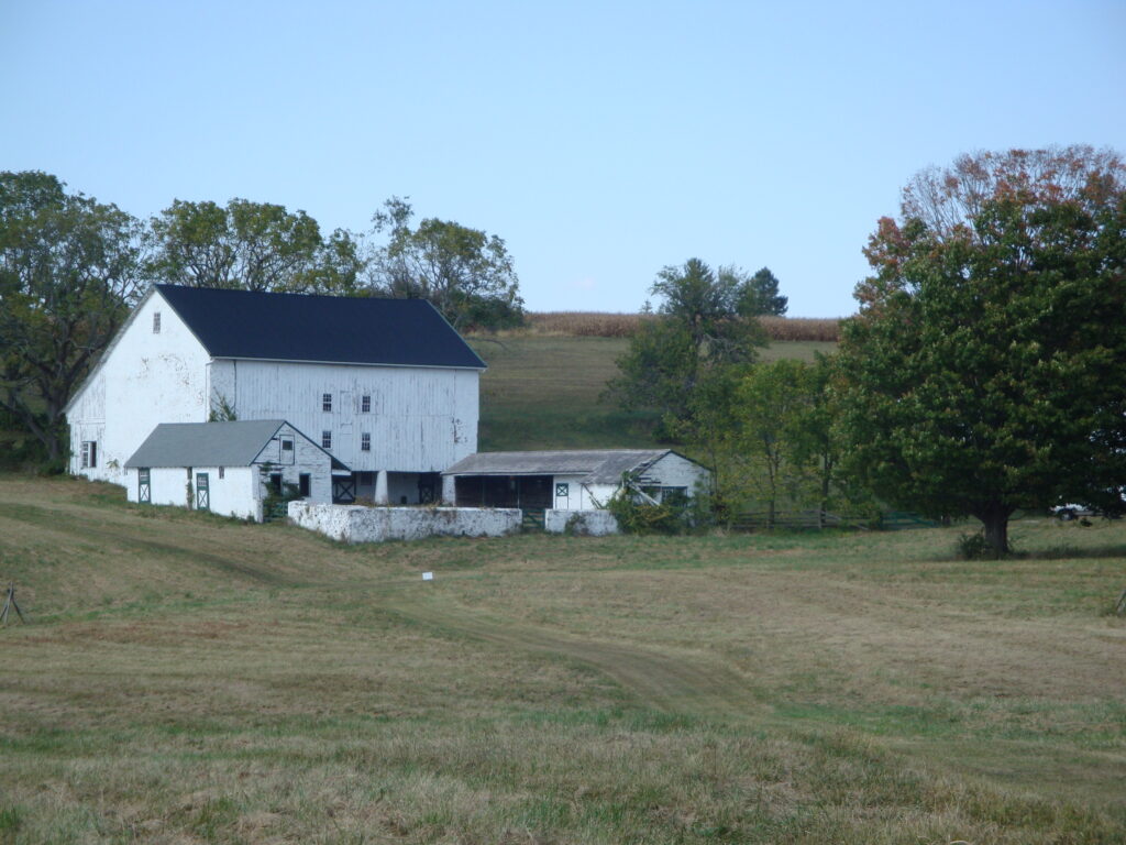
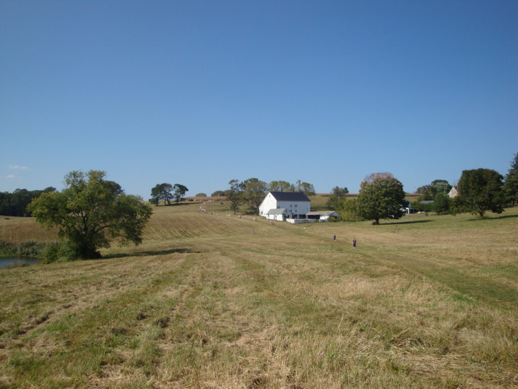
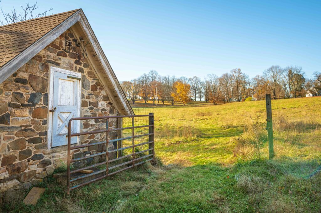
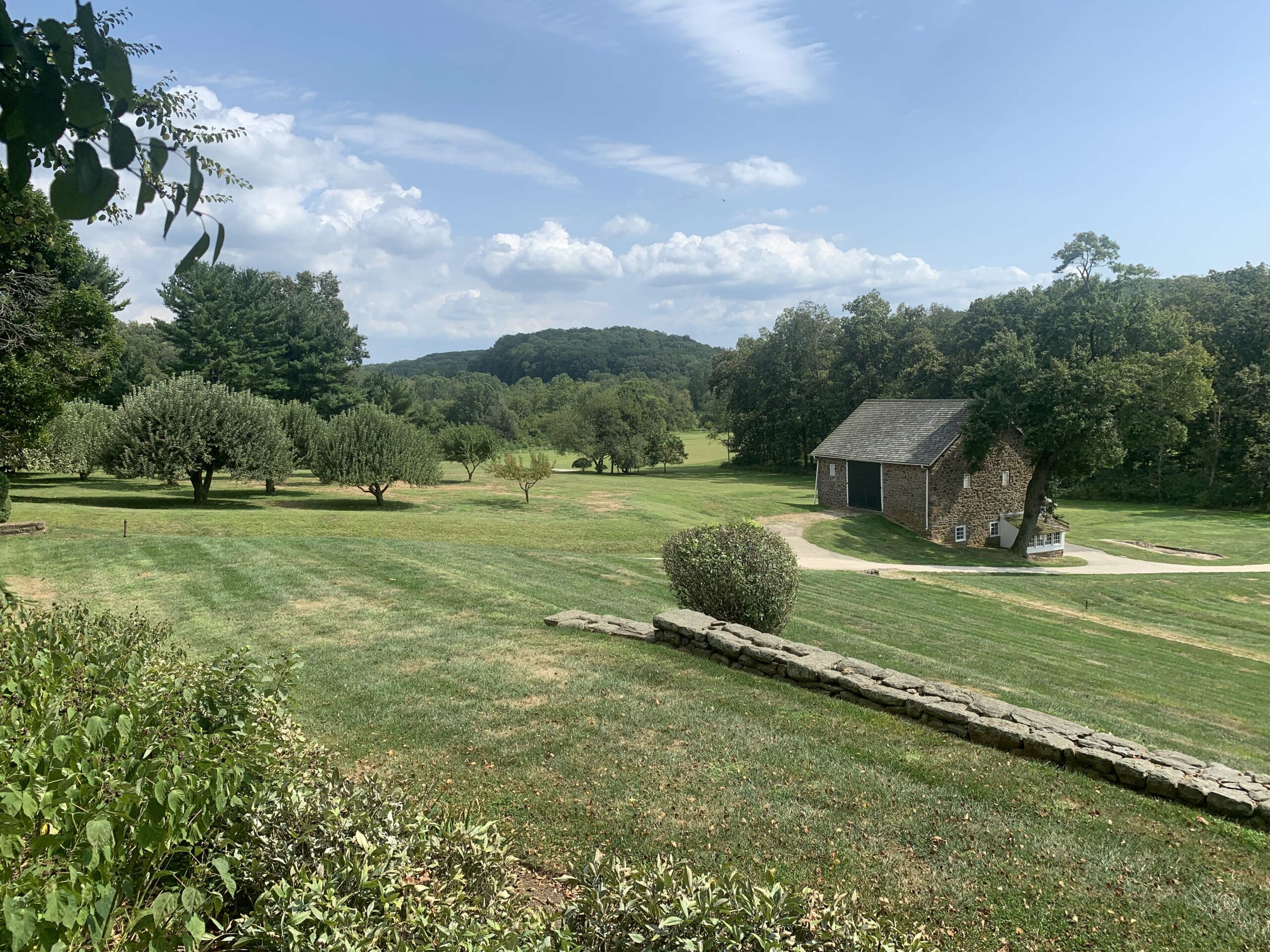
As many of you know, for years, Willistown Conservation Trust (WCT) has been interested in the future of Rock Hill Farm, a 246-acre property bordered by South Valley, Grubbs Mill, and White Horse Roads. We have been in discussions with both the former and current owners to explore ways to protect the land’s conservation values that would permanently preserve the natural and scenic resources found here.

Since the sale of Rock Hill Farm last year, WCT has continued to have conversations with the current owner with the hope that we can work toward a conservation outcome for the entire property. We are not able to share the specific details of easement discussions, but what we can tell you is that we are continuing to prioritize our conservation work at Rock Hill Farm. 

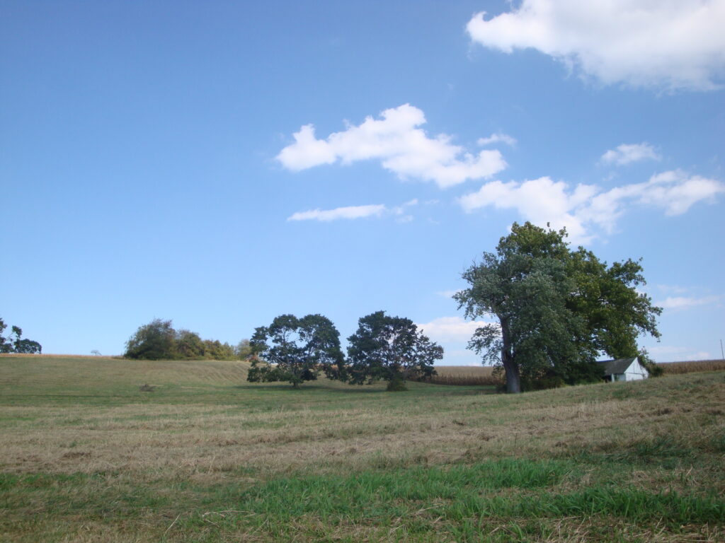
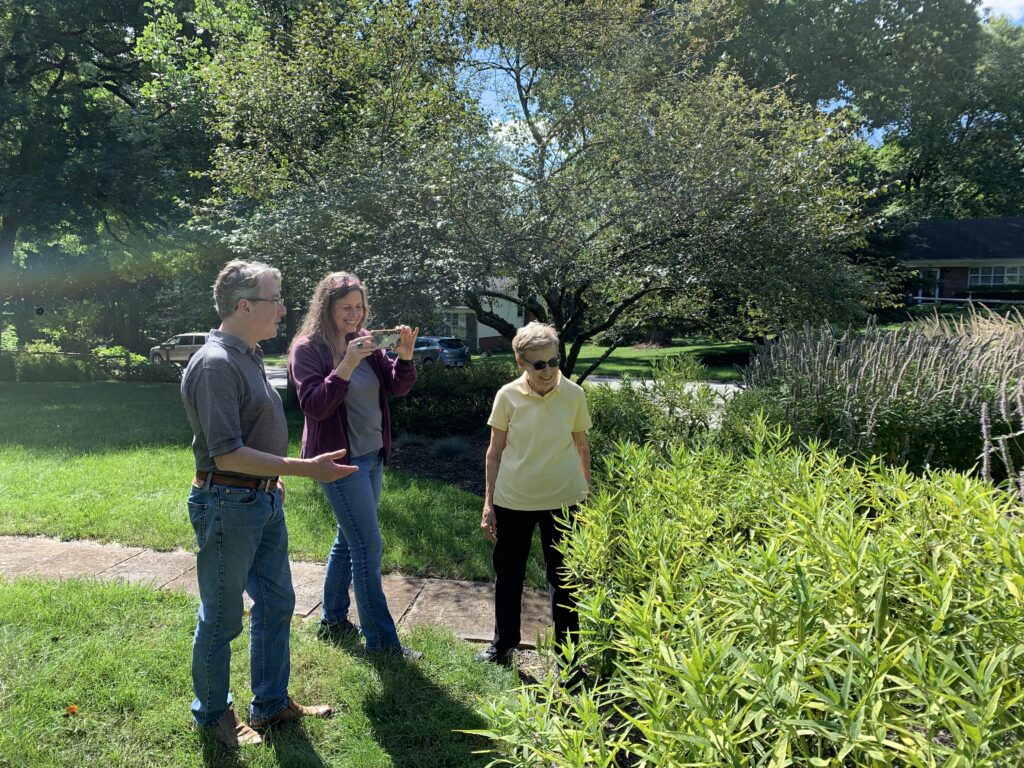
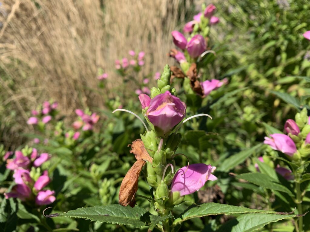
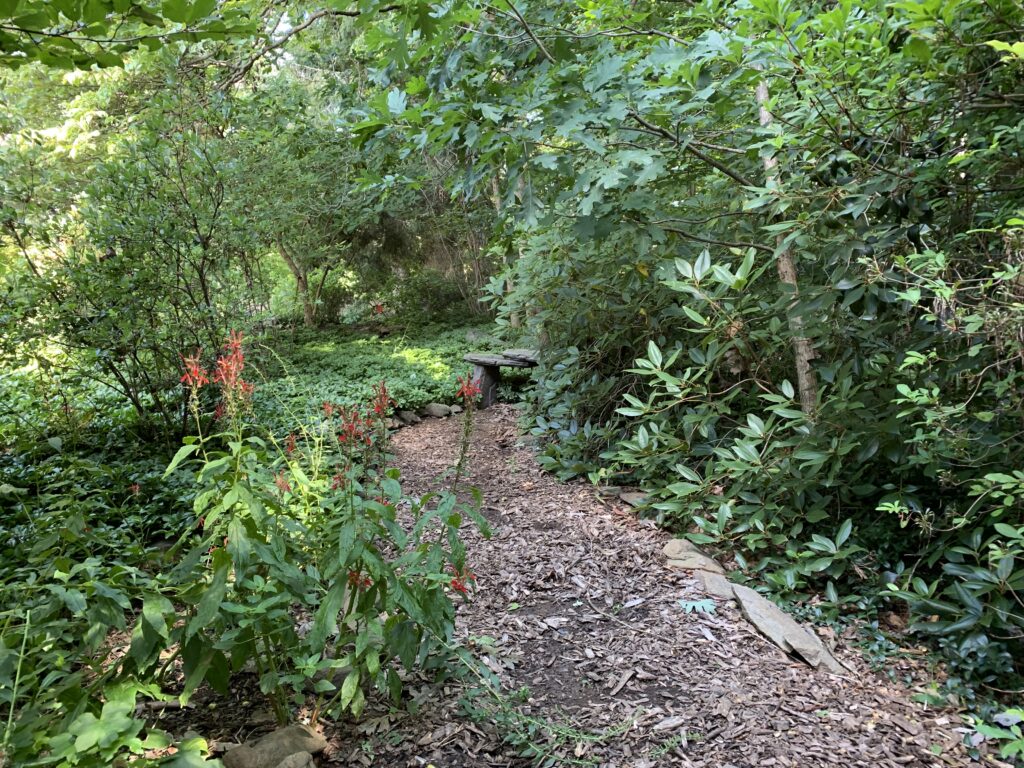
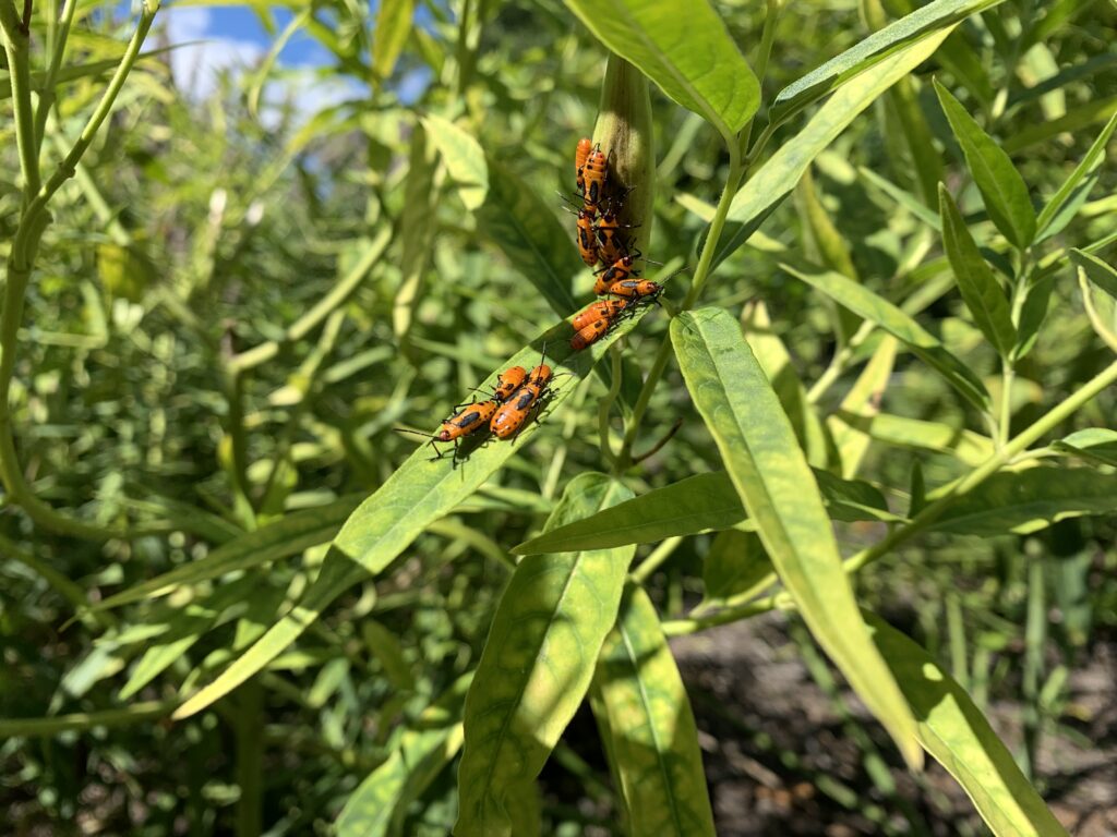
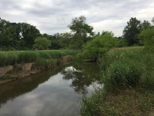
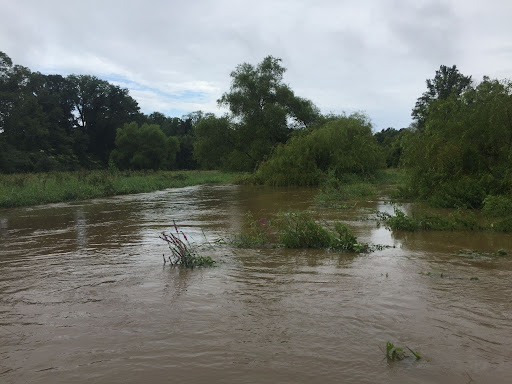
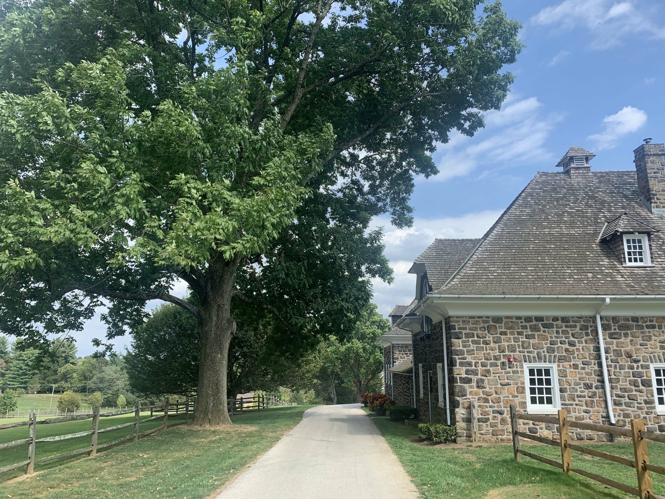
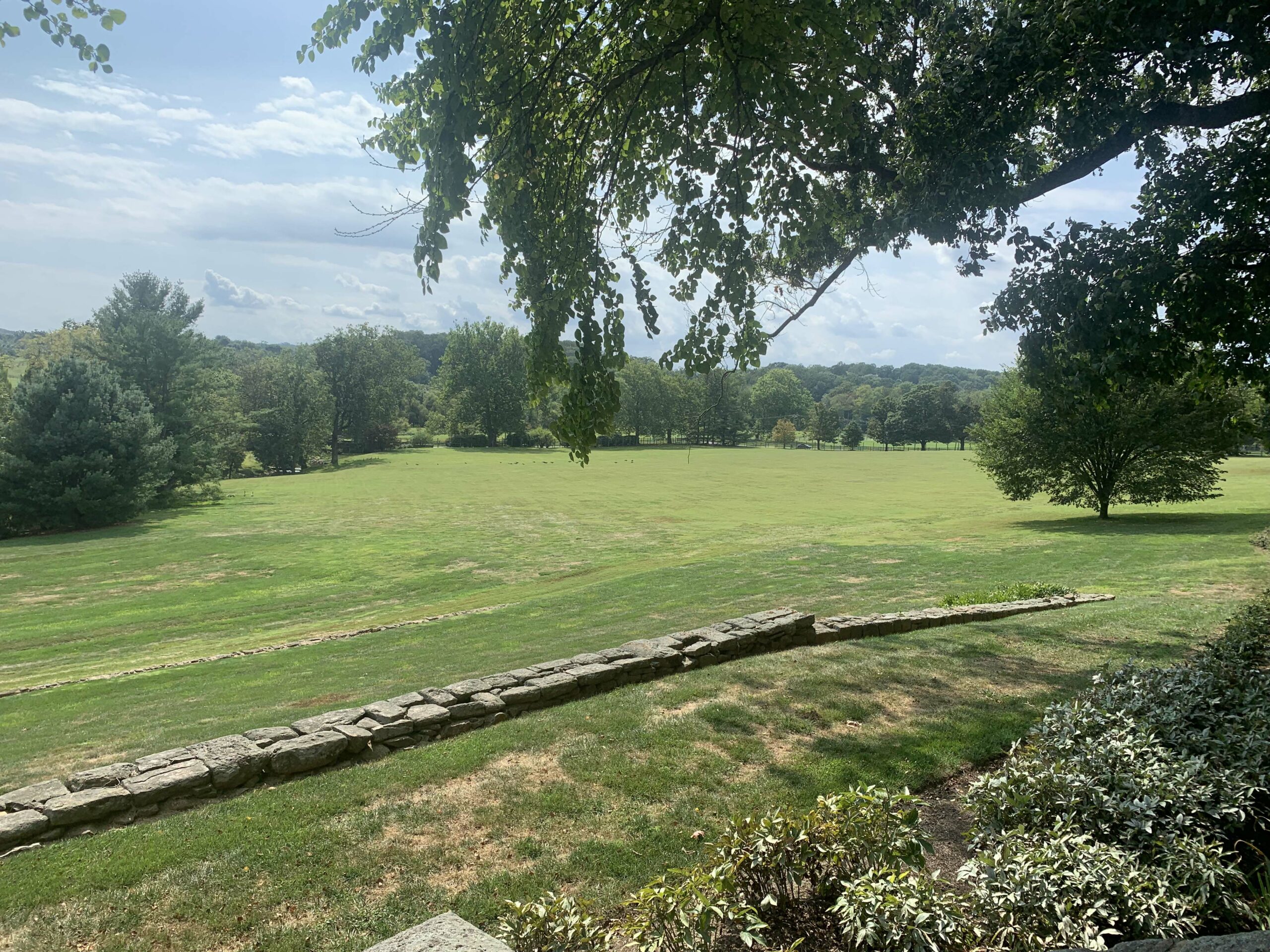
WCT’s role is to assist landowners in identifying constructive uses and protections for their property, particularly those with sensitive environmental features. Rock Hill Farm is a special property with an abundance of meadows, forests, historical structures, and a section of Crum Creek. Its open space connects with several conserved properties and other large tracts of land that provide important habitat for migratory birds and other wildlife, as well as scenic views for the enjoyment of the many people who travel along the South Valley Road corridor by bike, foot, or car. 

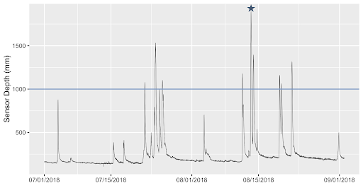
For years, WCT has assisted with the stewardship of Rock Hill Farm through tree plantings, and we’ve used the property as a site for our Watershed Protection Program’s research, which includes monthly water chemistry analysis and three years of annual macroinvertebrate sampling. We care deeply about what happens here, just like you do. And we pledge to do what we can to achieve a positive outcome.

Thank you for your steadfast support and shared concern about the future of this region’s open space. Please send this letter to your own friends and neighbors, and we will do our best to keep you updated on our progress.

Sincerely,


Kate Etherington

CONNECT

GIVE

LEARN

PARTICIPATE

Filed Under: Conservation, Land Protection

WCT Update on Kirkwood Farm

February 24, 2022 By Kate Etherington

Dear Friends and Neighbors,

For over 25 years, land protection has been the core of Willistown Conservation Trust’s (WCT) mission. Thanks to the generosity of the community and local landowners, and support of partnering organizations and funders, WCT has assisted in the conservation of thousands of acres in the region.

Despite these wonderful conservation success stories, there are pockets of open space, some quite large, that remain unprotected and vulnerable to development. WCT closely monitors these properties and their environmental resources, oftentimes for years, and tries to build relationships with landowners to work towards a conservation outcome – preserving open space for the protection and health of natural resources, and the enjoyment by the greater community.

Earlier this fall, we learned that Kirkwood Farm, a 218 acre parcel in the heart of the Willistown countryside between Providence and Plumsock Roads, surrounded by conserved lands, and a critical component of an established greenway, was to be marketed for sale. Its beauty and special natural resources include rolling hills and grasslands, mature woodlands, and two headwater tributaries to the high quality Ridley Creek. The Farm provides prime habitat for numerous species of wildlife and includes critical areas for declining nesting and migratory birds. It offers respite and visual beauty to the many people who travel the Providence Road corridor and use Plumsock Road for recreational enjoyment.

Although the real estate listing just became public, WCT and other conservation organizations have been working to develop a collaborative strategy to ultimately save this critical property from over-development. It remains a complex process due to several factors including the unusually strong real estate market and intense development pressure. We share this news because we know that you care about the countryside and desire, as we do, to preserve its rich reservoir of natural, scenic and recreational resources that could be lost forever if the property is converted into a multi-lot residential development.

It is our desire to help facilitate a plan that appeals to the owner and also ensures the protection of these natural resources. We will continue to work towards a positive solution and will strive to keep you informed. Meanwhile, please know that we are exceedingly grateful for your support and will work to achieve the best possible conservation outcome for Kirkwood Farm.

Please send this letter to concerned friends, neighbors, and conservationists who might wish to stay informed and learn more about the mission and programs of WCT.

Sincerely,

Kate Etherington

CONNECT

GIVE

LEARN

PARTICIPATE

Filed Under: Conservation, Land Protection

Willistown Conservation Trust and Delchester Group Inc. Partner to Permanently Protect 16 Acres on Grubbs Mill Road

November 22, 2021 By CommIntern

Of the 16 acres, nine will be added to the Trust’s Kirkwood Preserve

Willistown Conservation Trust is pleased to announce that up to nine acres will be added to Kirkwood Preserve, and seven acres surrounding the public nature preserve will ultimately be permanently protected with a conservation easement, thanks to a partnership with Delchester Group Inc. (DGI). Through the protection of the 16 acres, the Trust is forever preserving both critical bird habitat and an important piece of history within the Willistown countryside.

The 16-acre property – commonly known as the “Massey Farm” or the “Alpaca Barn” – can be found on Grubbs Mill Road, where it has gone on and off the market for the past couple of years. When the Trust and DGI learned that a developer from out of town was proposing to purchase the land and build up to four homes on Grubbs Mill and Goshen Roads, they knew they had to act quickly. Surrounded by conserved open space, public preserves, and the adjacent Historic White Horse Corner, development would be devastating to the natural and historic landscape of Willistown. DGI’s community of investors purchased the property in September; the Trust plans to purchase nine acres from DGI through private and public fundraising, and DGI will hold the remaining seven acres until the group finds a conservation buyer willing to preserve the property’s beauty, rural character, and open space. 

  • The Alpaca Farm (when it had alpacas) in 2003 | Photo by Jennifer Mathes
  • 9 acres of the property will be added to Kirkwood Preserve | Photo by Jennifer Mathes

The Trust’s nine acres will allow Kirkwood Preserve to expand across Grubbs Mill Road, with new public walking trails anticipated. Additionally, this parcel is part of the Upper Ridley/Crum Important Bird Area, and its rich habitat has been identified by the Audubon Society as critical for bird conservation. The grasslands on this property are vital for nesting birds. Listed as a Class II historic resource by Willistown Township, its conservation also preserves the history and legacy of Thomas Massey who purchased the land among 500 acres in 1699, and later passed it on to his son, James Massey who built the “James Massey House” (c.1790) and historic barn that exist on the property today.

The Trust intends to refurbish this Chester County, stone-posted bank barn, in addition to hosting many volunteer days at this site to clean up debris, remove invasive plant species, and spruce up the outdoor spaces around the barn and other structures. Stay tuned for a future volunteer day!

Filed Under: Conservation, Land Protection

A Suburban Nature Lover Seeks Legacy Easement to Protect Her Native Plant Oasis

October 25, 2021 By Blake Goll

By Blake Goll, Education Programs Manager and Erik Hetzel, Director of Land Protection

Photos by Blake Goll

Meandering along the cool wood chip paths beneath the varied canopy of beech, oak, and cherry trees, your eyes dance with the dappled light around the myriad understory shrubs­—first settling on this glossy leaved plant, then darting upwards to those feathered shadows that flit and call among the boughs above—and you almost forget that this dynamic nature escape is someone’s backyard.

There are an estimated 40-50 million acres of manicured lawn in the United States today (including residential, roadsides, and golf courses); this represents a significant loss in plant and habitat diversity that is necessary to support wildlife in these spaces. While we historically might have been able to justify this simplified approach to our green spaces, many of us now feel compelled to do more. Unsustainable human population growth coupled with harrowing reports of the planet having lost 30% of all birds since 1970 are a call to action. Fortunately, as Marianne Price’s property proves, with the right planning, the average American yard can easily contribute significantly to insect and bird populations.

It all starts with selecting native plant species to support a healthy food web (i.e., insects!).  A keystone species like a native oak tree, for example, is a major driver of Pennsylvania food webs; 511 species of our native caterpillars use oak trees as their host plant! When you consider that the majority of our songbirds raise their chicks on caterpillars, the value of native plants is clear. By contrast, a nonnative gingko tree supports only about 5 caterpillar species. 

  • Marianne Price

“My husband Karl and I bought this place in 1972 after the previous owner passed away,” Marianne explains. “He wanted the buyer to be someone who would take care of the property for the wild birds he loved so much. He’s the one who began stewarding this yard with native trees. I kept nurturing the trees and planting more, because I wanted to keep my word, and I’ve done just that. Here I am almost at the 50 year anniversary!” she gleams. Marianne has continued to care for this one-acre ecosystem, single-handedly taking on the responsibilities after Karl passed in 2007.

Marianne’s devotion to stewarding the property now extends well into the future, thanks to her commitment to conserving the land with Willistown Conservation Trust. Using a Legacy Easement, which is specifically designed for smaller properties like hers, Marianne approached the Trust’s Land Protection Program earlier this year. Director of Land Protection Erik Hetzel recalls, “I visited her property on a sunny October morning and was greeted by an oasis of nature in a suburban neighborhood. The place was buzzing with pollinators and birds.”

  • Erik Hetzel, Sue Costello and Marianne Price

The terms of Marianne’s easements are relatively simple, focusing on the preservation of native tree species, including vital species like the native oak that supports a myriad of caterpillar and bird species. The Trust’s Legacy Easement program uses a simplified easement model to conserve lands that might not be effectively protected by other means, such as through deed restrictions or covenants between neighboring property owners. This unique program opens the door for landowners with smaller properties to become conservationists in a new way, one that is more accessible. And Marianne’s easement will ensure the lasting stewardship of the habitat that she has nurtured over the last 50 years.

Like legacy easements, part of the reason why Marianne’s little sanctuary is so inspiring is that emulating it is doable. She is a plant enthusiast and has fun experimenting with different species and cultivars that are not all native. Experts say that even if you strive for 70% native plant biomass and allow the other 30% to be other (noninvasive) plants of interest, you can still contribute to the growth of suburban bird populations like chickadees. It does not have to be an all or nothing effort. The average American lawn can easily attract at least 50 kinds of beautiful and interesting birds with the right planning!

With a keen eye for sustainability, Marianne even strives to make her watering practices environmentally friendly.  Although her diverse landscape of hardy perennials, shrubs, and deep-rooted trees requires less water that a typical Kentucky bluegrass lawn, she still needs to water during dry spells. She cleverly collects the used “gray water” from her air conditioning unit, de-humidifier, and even her laundry washing machine! She pumps this reusable water into covered storage barrels tucked around her property for watering.

Finally, when you consider that each hour of lawn mowing generates as much pollution as driving a car nearly 100 miles, it also becomes apparent how a property like Marianne’s demonstrates a more carbon neutral solution to an all-lawn landscape. From saving water and reducing carbon emissions to contributing to biodiversity, Marianne is truly an inspiration to us all — proving that an average-sized suburban landscape can be transformed from a uniform green patch to an alluring conservation oasis. 

Blake Goll | she/her | Education Programs Manager | Blake plays a big role in the Trust’s Bird Conservation Program, as well as the outreach and educational initiatives as the coordinator for Rushton Nature Keepers program.

Erik Hetzel | he/him | Director of Land Protection and Public Grants | As part of our Land Protection Program, Erik handles the acquisition of private conservation easements and public lands to add to our nature preserves.

—-

Legacy Easements open the door for landowners with smaller properties to become conservationists in a new way.  To learn more about how you can be a part of the conservation movement with a Legacy Easement on your property, contact Erik Hetzel at ewh@wctrust.org.

Filed Under: Conservation, Land Protection, Native Plants

Flooding 101

August 23, 2021 By Anna Willig

As we approach the last few weeks of summer heat and humidity, we approach peak seasons for thunderstorms and flooding. Last Thursday, heavy rainfalls led to the first major flood of the year in our area. At Ashbridge Preserve, Ridley Creek rose over 2 meters (7 feet) in about 3 hours, pouring out of its banks. In the wake of these floods, we wanted to take the opportunity to answer some commonly asked questions about the fundamentals of flooding.

What is a flood?

The United States Geological Survey (USGS) defines a flood as “any relatively high streamflow overtopping the natural or artificial banks in any reach of a stream” (USGS, 2019). In other words, a flood happens when a stream breaches its banks, resulting in water flowing over areas that are not normally part of the stream. Floods can occur for a number of reasons, from snow melt to rain to changes in tides. In our area, the most common cause of flooding is rain, often from summer storms, and snow melt after large snowfalls.

Ridley Creek before (left) and during (left) a flood at Ashbridge Preserve in 2018. Photos by author.

How frequently do floods occur? 

Floods can occur several times a year, whenever rain or snowmelt causes a stream to overflow its banks. Small floods, when the stream barely breaches its banks, are more common than large floods when the water pours out of its banks.

The size of a flood is determined by the peak flow of a stream or the greatest amount of water moving through the stream during a flood event. Peak flow can be determined by measuring the height of a stream; it is the highest height during the flood event. Higher peak flows indicate larger floods and lower peak flows indicate smaller floods.

This graph shows water depth over time and nine floods that happened at Ashbridge Preserve in the Summer of 2018. The blue line represents the depth at which the stream completely fills its bank–a flood occurs any time the water rises above this depth. Each spike represents a rainstorm and the peak flow, which determines the size of a flood, is the highest depth in each storm. The star represents the peak flow of the flood that is pictured above.   

Floods are classified by how often we expect them to occur. A 100-year flood is a flood of a given size that has a 1% chance of occurring each year. Similarly, a 500-year flood has a 0.2% chance of occurring each year and a 1000-year flood has a 0.1% chance of occurring each year. However, this does not mean that a 100-year flood will only occur once every 100 years or that a 1000-year flood will occur once every 1000 years. It simply refers to the likelihood of such a flood happening each year. 

How do you stay safe during a flood?

Floods in our area can be dangerous, even life-threatening. According to a recently completed Hazard Risk Assessment by Chester County, flooding is the second highest risk hazard in the county. Floods can damage property, destroy roads and bridges, and threaten human lives. 

Floodwaters are most dangerous for drivers, especially when drivers try to cross flooded roads. Twelve inches of flowing water will move a car, and 2 feet of water will easily sweep a car away. Even just a few inches of water can immobilize a car, stranding drivers in the middle of a road. If you are driving during a rainstorm, do not drive through any floodwater. Floodwater is often dark and murky, making it difficult to judge how much water is actually on the road and if the water is flowing. Turn around and find another route or pull over and wait until the water goes down.

Want to learn more about flooding?

Stay tuned next week for Flooding 102, which takes a deeper dive into how land use decisions impact flooding in our area. Until then, check out some of these resources:

  • Monitor streams in Pennsylvania for real-time flooding: Streamflow conditions 
  • Check out real-time stream monitoring data in Ridley and Crum Creeks near Willistown: EnviroDIY Sensor Stations
  • Learn more about flood risk and historical flooding in Chester County: Risk Assessment – Flood, Flash Flood, Ice Jam
  • Learn more about how to stay safe during a flood: Turn Around Don’t Drown

USGS. (2019). Floods and Recurrence Intervals: Overview [Techniques and Methods]. USGS.
https://www.usgs.gov/special-topic/water-science-school/science/floods-and-recurrence-intervals?qt-science_center_objects=0#qt-science_center_objects

Filed Under: Conservation, Education, Land Protection, Science, Watershed Tagged With: pollution

  • « Previous Page
  • 1
  • 2
  • 3
  • 4
  • 5
  • …
  • 13
  • Next Page »

CONTACT

925 Providence Road
Newtown Square, PA 19073
(610) 353-2562
land@wctrust.org

JOIN OUR MAILING LIST

Copyright © 2025 · WCTRUST.ORG