WILLISTOWN CONSERVATION TRUST

  • Facebook
  • Instagram
  • LinkedIn
  • YouTube
DONATE
  • About
    • HOW WE WORK
    • WHERE WE WORK
    • OUR STAFF AND TRUSTEES
    • JOBS & INTERNSHIPS
    • VOLUNTEER
    • RUSHTON CONSERVATION CENTER
    • STRATEGIC PLAN
    • DIVERSITY, EQUITY & INCLUSION STATEMENT
    • FAQs
  • LATEST
    • BLOG
    • IN THE NEWS
    • PUBLICATIONS
    • PHOTOS
  • PROGRAMS
    • BIRD CONSERVATION
    • COMMUNITY FARM
    • EDUCATION
    • LAND PROTECTION
    • STEWARDSHIP
    • WATERSHED PROTECTION
  • NATURE PRESERVES
    • ASHBRIDGE PRESERVE
    • HARTMAN MEADOW
    • KESTREL HILL PRESERVE
    • KIRKWOOD PRESERVE
    • RUSHTON WOODS PRESERVE
  • EVENTS
    • EVENT CALENDAR
    • BARNS & BBQ
    • RUN-A-MUCK
    • WILDFLOWER WEEK
    • ECOCENTRIC EXPERIENCE
    • RUSHTON NATURE KEEPERS (RNK)
    • ACCESS Program
  • Support
    • WAYS TO GIVE
    • SPONSOR THE TRUST
    • CORPORATE PARTNERSHIP PROGRAM
    • JOIN THE SYCAMORE SOCIETY
    • LEGACY SOCIETY & PLANNED GIVING
    • DELCO Gives 2025
  • CAMPAIGN FOR KESTREL HILL PRESERVE

Willistown Conservation Trust and Natural Lands Receive $25,000 from the Cornell Lab of Ornithology to Reverse the Decline of Grassland Birds in Chester County

June 28, 2023 By CommIntern

The land trusts will promote land management practices that benefit the Bobolink, Eastern Meadowlark, and Grasshopper Sparrow


Eastern Meadowlark captured and released by WCT staff on a local farm. Photo by Aaron Coolman

The Cornell Land Trust Bird Conservation Initiative has awarded Willistown Conservation Trust (WCT) and Natural Lands a $25,000 grant to promote grassland conservation in the greater Doe Run area of Chester County. The Cornell Land Trust grant will support the Grassland Bird Collaboration (GBC) — launched by WCT in 2022 — and their goal to create a grassland bird conservation area made up of working landscapes and existing preserves in southern Chester County. This “working conservation landscape” will benefit grassland bird species that have been in decline due to changes in farming practices and increased land development. The GBC will create a focal area where partners can work together to address these issues affecting grassland birds, while maximizing conservation and minimizing disruption to agricultural production.

The GBC works with landowners and farmers to conserve and augment grassland bird populations through conservation land management practices, research, education, and community engagement. With this grant, WCT will lead the initiative by working on private lands educating landowners on best land management practices to conserve three focal grassland bird species — Bobolink, Eastern Meadowlark, and Grasshopper Sparrow — while Natural Lands uses its network of publicly accessible nature preserves to manage land for these grassland birds.


WCT staff prepare to track grassland birds. Photo by Willistown Conservation Trust

One of the most vital land management practices is delaying mowing during the breeding period. Mowing before birds complete their nesting cycle removes available habitat. Implementing a “no-mow” period when there are babies and fledglings in a field allows young birds to develop in a safe environment before the nesting grounds are disturbed.

So far, the GBC has partnered with landowners and farmers to enroll more than 750 acres of privately held land in “bird-sensitive” field management practices to accommodate the focal species’ annual breeding cycle. This enthusiasm is largely thanks to WCT having built relationships with these landowners and farmers since 2014. Additionally, Natural Lands will employ best management practices, monitor their nature preserves — including Stroud Preserve, Cheslen Preserve, and Bryn Coed Preserve — during breeding season, and promote these practices through demonstration areas and outreach efforts.


A Bobolink captured and released by WCT staff at a Chester County property. Photo by Amanda Dunbar

The project will also include a research component using the Motus Wildlife Tracking System to gain insights into how Bobolinks use the working landscape of Chester County. Since 2021, WCT has been using nanotags to track Bobolink movement among fields during breeding and through migration. This collection of data provides a greater understanding of habitat use and connectivity.

“When we share Motus data that show the birds’ use of local fields and the benefit of delayed mowing, landowners understand the importance of their fields for grassland bird conservation,” says Lisa Kiziuk, Willistown Conservation Trust’s director of bird conservation program. “The Motus data have become a tool for understanding the birds’ needs and a tool for public engagement.” 

Chester County is well positioned to support this conservation effort largely thanks to local mushroom farms’ demand for mulch hay. Mushroom houses prefer later-season hay that has been left to mature and dry in the fields. Providing for the mushroom market means there is less disruption to farming practices and to the grassland birds during their crucial breeding period. “The unique local agricultural market provides a great opportunity to work with farmers to meet our conservation goals,” says Zoë Warner, project manager for the Grassland Bird Collaboration. “This enables us to increase the value of conserved land within a large contiguous preservation belt. The land will not simply be ‘open space.’ It will provide valuable and essential breeding grounds to help reverse the precipitous decline of grassland birds.”

Baby Bobolinks in a nest that has been protected thanks to no-mow practices. Photo by Amanda Dunbar

“Our shared vision is to create a grassland bird conservation area made up of working landscapes and existing nature preserves in southern Chester County,” says Gary Gimbert, Natural Lands’ vice president of stewardship. “Natural Lands’ nature preserves in Chester County alone total more than 4,000 acres. We are excited to use our properties to help establish a focal conservation area that protects grassland bird species during the breeding cycle.”

“The Grassland Bird Collaboration complements the work Stroud Water Research Center has undertaken to improve stream quality throughout the greater Doe Run area,” says David Arscott, Ph.D., executive director and research scientist at Stroud Water Research Center. “Improving meadow and hay/pasture management to enhance grassland bird habitat is synergistic with our activities, and we are supportive of working together with landowners, WCT, and Natural Lands to implement these practices.”

WCT Media Contact: Monica McQuail, mjm@wctrust.org

Natural Lands Media Contact: Kirsten Werner, kwerner@natlands.org
Filed Under: Bird Banding, Bird Conservation, Conservation, Motus, Nature Preserves

Willistown Conservation Trust to Establish a Public Preserve on Recently Sold Kirkwood Farm Property

June 7, 2023 By Communications Team

A conservation outcome for Kirkwood Farm has been guaranteed, thanks to Willistown Conservation Trust who — with support from conservation partners and donors — will purchase 90 acres of the 218-acre Kirkwood Farm property for the creation of a public nature preserve. 

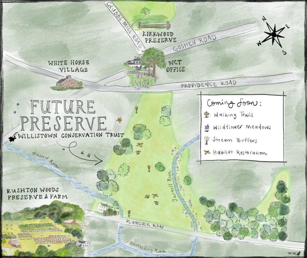
Kirkwood Farm — located on Plumsock and Providence Roads across from Willistown Conservation Trust (WCT) headquarters — was originally listed for sale during fall of last year, and in March 2023, movie director and screenwriter M. Night Shyamalan purchased it, ensuring that its 218 acres would not be lost to development. WCT had been invested in Kirkwood Farm’s fate for years, and the environmental nonprofit worked with Shyamalan to finalize its sale and plan for its future — a future that now includes further protective measures and this vision for a preserve, as outlined in the agreement of sale signed on June 2.

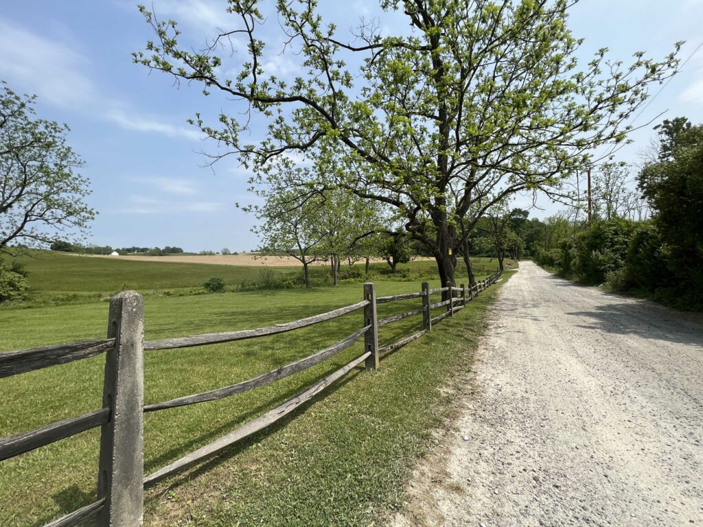
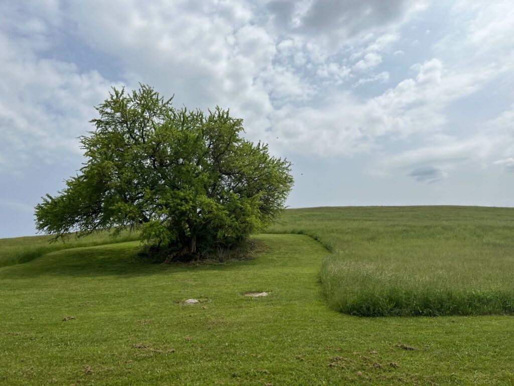
The future preserve boasts rolling hills and grasslands
View of the future preserve from Plumsock Road

WCT President and Executive Director Kate Etherington notes, “The chance to acquire and protect another portion of Kirkwood Farm is a dream come true for Willistown Conservation Trust. This future preserve will be an incredible asset to our community by providing public open space for all to enjoy, while protecting its abundant natural resources for generations to come.”  WCT Board Chair John Stoviak adds, “We are very grateful to Willistown Township, Chester County, Firstrust Bank, and WCT’s supporters for helping WCT pursue this game-changing opportunity.”

Originally 550 acres and owned by descendants of the Rockefeller family with a history that can be traced back to the 1700s, Kirkwood Farm sits at the heart of the Willistown countryside. Prior to its sale, it had been owned by the Rockefeller family for over 100 years. In 2004, WCT helped save a portion of the Farm by purchasing and protecting 95 acres as nearby Kirkwood Preserve located at 855 Grubbs Mill Road in Newtown Square. 

The future preserve’s beauty and natural resources include rolling hills and grasslands, mature woodlands, and two headwater tributaries to the Ridley Creek, designated as High Quality Waters by the Pennsylvania Department of Environmental Protection. The land provides prime habitat for numerous species of wildlife and includes critical areas for declining numbers of nesting and migratory birds. 

It is also an important connective piece between other local public preserves — including Rushton Woods Preserve, Kirkwood Preserve, and Okehocking Preserve — and once WCT establishes new trails here, it will enhance the greater network of hiking and riding trails enjoyed by so many. Additionally, WCT intends to restore habitat, create stream buffers, and plant native wildflower meadows to benefit wildlife.

WCT has already received funding for this project from private donors, in addition to a $500,000 grant awarded by the Chester County Commissioners that will go toward the anticipated $9 million purchase price and additional endowment.

Say County Commissioners Marian Moskowitz, Josh Maxwell, and Michelle Kichline, “The beauty of Kirkwood Farm can be found in both its spectacular landscape and vistas, as well as its ability to be publicly accessible in the near future, with planned parking and connections to surrounding preserved land. We are very pleased to partner with Willistown Conservation Trust on this project and thank them for their diligence in ensuring this portion of Kirkwood Farm remains forever protected.” 

The 90 acres is not open to the public at this time. To learn more about this preserve in the making, please visit wctrust.org/future-preserve

Press Contact: Monica McQuail, mjm@wctrust.org

Filed Under: Conservation, Land Protection

Request for Proposal | Rushton Woods Preserve

January 25, 2023 By Andrew Kirkpatrick

Cover Photo by Jennifer Mathes

Project

Willistown Conservation Trust is seeking proposals for the design, permitting, and construction of a bioretention basin with level spreader and a vegetated swale and ADA path at Rushton Woods Preserve.

The basin and swale will be used to reduce the peak flow of stormwater runoff and prevent further erosion adjacent to Okehocking Run, a tributary of Ridley Creek.

Scope of Work

Budget | The anticipated budget for this project is approximately $254,000-274,000

Background | Willistown Conservation Trust is a 501 c3 non-profit land trust located in Willistown Township, Chester County PA. The trust operates four nature preserves open to the public year round. Our program areas include community farm, bird conservation, watershed protection, and habitat protection. As part of our Rushton Woods Master Plan, we are continuing to develop and enhance the resources of the preserve through a combination of habitat restoration, stormwater management, and accessibility.

Proposal Criteria | The following information should be included in the proposal:

  • Company background and qualifications
  • Experience with similar projects
  • Project approach and timeline
  • Detailed cost estimate, including design, permitting, and construction costs
  • Description of the proposed materials and equipment to be used
  • References for similar projects
  • Any additional information relevant to the proposal
  • Only PA Native Plant Species are to be used in this project.

Required Experience

  • Focus of professional practice should be ecologically sound design principles.
  • Ability to demonstrate past experience in the successful design, permitting, and construction of at least three similar green infrastructure stormwater BMPs.
  • Minimum five to ten years’ experience in the environmental planning, landscape architecture,
    stormwater design, and engineering fields.
  • Past experience and demonstrated expertise in working through PA DCNR grant administration
    procedures.
  • The ability to demonstrate expert knowledge and use of local PA native plant species.
  • Professional Engineer and Landscape Architect on staff to seal documents.

Selection Criteria and Timelines

  • This is a competitive lowest price bid. All bids must be received by 5:00 pm February 3, 2023 to be considered. Award of contract will be announced the following week.
  • Design and permitting is expected to be completed by January 2024 and construction to begin in May 2024.
  • Prevailing Wage Rate applies to this project.
  • Nondiscrimination/Sexual Harassment Clause

Concerns, Questions, and Roadblocks
This a grant funded project with funding from PA DCNR and PA DEP. Contractors should be well versed in following grant administration guidelines for project execution.

Willistown Conservation Trust reserves the right to reject any and all proposals and to waive any irregularities in the proposal process.

Download the full Proposal Requirements Here.

Email Stewardship Director Andrew Kirkpatrick (ajk@wctrust.org) with your bid or any questions Here.

Filed Under: Conservation, Stewardship

Capturing a Snapshot of Darby Creek

December 7, 2022 By Anna Willig

By WCT Conservation Research and Data Specialist Anna Willig 

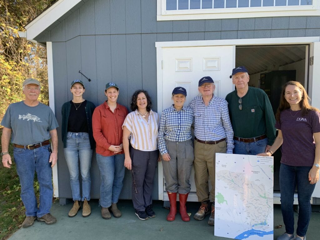
At the beginning of November, the Watershed Protection Program at Willistown Conservation Trust (WCT) partnered with the Darby Creek Valley Watershed Association (DCVA) and, together, enlisted four volunteers to conduct a sampling “blitz” in the Darby Creek Watershed. With the help of our determined volunteers, we collected samples from 19 previously unstudied sites in two hours (Map 1). Once the volunteers collected the samples, everyone met at the Upper Main Line YMCA’s Artisan Village to analyze water quality and discuss the results. 

Our Team (from left to right): Charlie Coulter (volunteer), Anna Willig (WCT, author), Lauren McGrath, Michelle Lampley (UMLY), Deirdre Gordon (volunteer), Lloyd Cole (volunteer), Dale Weaver (volunteer), and Aurora Dizel (DCVA).

Darby Creek originates in small tributaries along the Route 30 corridor from Easttown to Ardmore which flow together as the stream makes its way towards John Heinz National Wildlife Refuge where it meets the Delaware River. Throughout its length, Darby Creek flows through many highly developed areas, picking up road salts, fertilizers, and other pollutants from lawns, parking lots, and roadways. 

Despite these threats to the health of the stream, few community science studies have been completed to understand the health of Darby Creek and all of its tributaries. To shed some light on the water quality in the Darby Creek Watershed, the Darby Creek Community Science Monitoring Program was launched in 2021 in partnership with DCVA and under the scientific guidance of Stroud Water Research Center. To date, volunteers have been trained to collect high quality water chemistry data at 15 sites throughout the entire watershed every four weeks. 

The sampling blitz, which covered 19 sites in the headwaters of Darby Creek, allowed us to gain even more information on water quality while controlling for weather conditions. Rain, heat, and other weather conditions can impact water quality measurements. By sampling at a single point in time, we can capture differences in water quality between sample sites rather than changes caused by time. Many of the sampling sites were located on small tributaries, allowing us to study how fine-scale differences in land use upstream of the sample site can impact water quality. 

One of the goals of the sampling blitz was to understand salt pollution in the headwaters of Darby Creek. Road salts applied in the winter end up in streams as snow and ice melt and flow into the nearest waterway. Salts can build up in groundwater and soils, resulting in long-term increases in salt concentration in streams, a phenomenon known as freshwater salinization. Freshwater salinization is occurring across North America, and increases in salt concentration threaten the fish, insects, mussels, and other organisms living in streams. By measuring salt concentration in November, before winter road salts are applied, we capture baseline concentrations that reflect long-term buildup of salts in soils and groundwater. 

The results of the sampling blitz indicate that salt pollution (as measured by chloride concentration) varied widely across the headwaters of Darby Creek. Chloride concentration ranged from 34 ppm to 230 ppm (Map 1). The lowest chloride concentration was measured at Site 19, a site located on Camp Run, a small tributary to Darby Creek. The area that drains into Camp Run is predominantly agricultural land, with some sections of limited residential development and forest. By contrast, chloride concentration was highest at Site 2, a site on an unnamed tributary. The land that drains into Site 2 is similar to the size of the Camp Run watershed, but is much more developed. The tributary originates near a SEPTA train station and flows under Route 30, picking up salt and contamination from residential and commercial developments. Identifying pollution hotspots, such as Site 2, can help determine areas that should be targeted for future restoration. 

Map 1. Sample sites in the headwaters of Darby Creek. Each point represents the approximate location of a sample site and is colored by the chloride concentration at that site. Low chloride concentrations are represented by pale yellow, with high chloride concentrations represented by a dark red. The red box indicates the sample area.

Another indicator of water quality that volunteers measured was specific conductivity, which reflects how well electricity can move through water. Pure water is a poor conductor and has a low conductivity. As more ions are added to the water — from pollutants such as salts, fertilizers, and heavy metals — conductivity increases. Conductivity also varied greatly between sites, ranging from 325 to 967 μS/cm. While a higher conductivity indicates a higher concentration of pollutants, it does not indicate the type of pollutant. When chloride (which is an ion that increases conductivity) is compared to conductivity at each site, we found that there is a strong relationship between the two measurements (shown by the trendline), indicating that salt pollution is the biggest driver of conductivity in the headwaters of Darby Creek (Figure 1). However, there are two sites, Site 1 and Site 9, that do not quite follow the relationship. Further research is needed to understand what is driving conductivity at these sites. To learn more about conductivity, check out the State of Our Streams Report. 

Figure 1. The relationship between chloride concentration and specific conductivity in the headwaters of Darby Creek. Each point represents a chloride concentration and specific conductivity measurement taken at a sample site. Points are colored by site. 

The results of the snapshot survey indicate that water quality is highly variable in the headwaters of Darby Creek. Sites that drain the highly-developed Route 30 corridor, such as Site 2 and Site 5, have relatively poor water quality, while sites that drain areas with more open space, such as Site 18 and Site 19, have much better water quality. The variability in water quality within a small section of the Darby Creek Watershed highlights the deep connection between local land use and stream health. Protecting areas of open space, especially in small tributaries, is crucial to maintaining and improving water quality throughout the entire watershed. 

Additionally, increasing awareness of threats to water quality, such as winter road salt application, can help to reduce the impact on local streams. To reduce road salt contamination in streams, avoid over applying salt and sweep up any salt that remains after snow and ice have melted. The salt can be reused for the next winter storm, saving money and helping improve water quality! 

This snapshot survey was a pilot for a larger survey WCT, DCVA, and Stroud Water Research Center are hoping to conduct in the spring. We are deeply grateful to the Upper Main Line YMCA for hosting this event and to our fantastic volunteers who were willing and eager to explore new sections of stream to collect this data. The snapshot survey would not have been possible without our partnerships with DCVA and Stroud Water Research Center. If you are interested in joining our community science program, please contact Lauren McGrath at lbm@wctrust.org. 

Filed Under: Conservation, Nature, Science, Volunteers, Watershed

My Conservation Journey: A Tale of Two Countries

December 1, 2022 By Bird Conservation Team

By WCT Bird Conservation Associate Phillys N. Gichuru
Cover Photo by Jennifer Mathes

My first memorable conservation experience was when, as an undergrad, my population genetics professor walked into the classroom and very nonchalantly said he was going to miss one of our classes, because he was going to participate in the translocation of elephants from the larger Narok area into Maasai Mara National Park in Kenya. Of course, all five of us in the classroom asked if we could go along too. That experience is how I was sold on conservation as a viable career option for me. It was the thrill, the tender care for each animal, and the passion for the job that drew me in. This was true for every job experience I took on after that. 

I went on to work with Ol Pejeta Conservancy as a field technician affiliated with my university at the time, collecting black rhino (Diceros bicornis) dung samples for non-invasive genetic analysis to study population genetics. Technically, the fresher the dung, the better the chances of getting DNA from it. What was most endearing about this experience is because black rhinos are critically endangered, at the time, every rhino in this population was monitored very closely to reduce poaching incidences. Over time, each warden knew every little detail about the rhinos, and they called you when the dung was fresh with a bonus story of how they had just gotten chased by a rhino and had the torn trousers to prove it. 

While conservation in Kenya and the US is very similar in a lot of aspects — including my observations they both rely heavily on donors/fundraising, habitat loss is a never-ending concern, and passion drives most people in this field — it is also very different. Most of Kenya’s wildlife can be found in protected areas, Kenya does not employ hunting as a model of conservation, and most obviously, we have a lot more charismatic megafauna that tend to get a lot of attention. In parallel, Kenya heavily relies on tourism to fund conservation. Protected areas in Kenya are either federally owned (National Parks) or privately owned (mostly conservancies). While there are private conservancies, the federal government has a huge stake in management of endangered/critically endangered species such as the elephants, black rhinos, Hirolas, Sable, and Roan antelopes, wild dogs, Grevy (zebras). 

Oh! If it wasn’t obvious, we took part in that elephant translocation. The adults get darted and tranquilized from a helicopter and you swoop in very fast with a 4-wheel car right before they go down. To tranquilize the calves, if present, we load them on a huge truck and move them to the park. It takes phenomenal precision.

Now at WCT, I am far from the savanna and I work to conserve animals that are significantly smaller than the elephants and rhinos. I’ve found that the precision required in the elephant translocation process lends itself to the precise skills used to gently remove birds from our mist nets before wrapping tiny bands around their slim legs in the bird banding process. Conservation comes in all shapes and sizes.

To learn more about the science of endangered feces, click here.

— By WCT Bird Conservation Associate Phillys N. Gichuru

Filed Under: Bird Banding, Bird Conservation, Conservation, Nature, Staff

  • 1
  • 2
  • 3
  • …
  • 13
  • Next Page »

CONTACT

925 Providence Road
Newtown Square, PA 19073
(610) 353-2562
land@wctrust.org

JOIN OUR MAILING LIST

Copyright © 2025 · WCTRUST.ORG