By: Rhys Hals
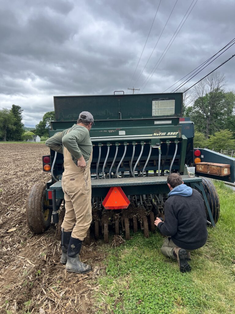
Erosion of streambeds is a major threat to the health of our ecosystems. Some erosion over time is natural, but too much too quickly results in soil getting washed away and deposited elsewhere, greatly altering the state of the stream, the biodiversity in it, and the overall aquatic habitat. During intense rain events, water washes over impervious surfaces such as parking lots and driveways and picks up speed as it heads toward a stream. As it makes its way across the land, this water cuts down and through the soil. When the water reaches the stream and has a lot of velocity from heavy rain, it can widen the streambed, or cause erosion near the headwaters of the water body. A deep crevice caused by this kind of erosion near the headwaters of a stream is called a headcut.
Headwaters are the source or origin of a stream or creek, the furthest point from where the steam empties. Headwaters are vital in ecological health1. Yet, despite the importance of these waters, they are disproportionately unmonitored. As runoff from highly developed or agricultural areas empties into headwaters, the stability of the stream is thrown off. The water can become overrun with chemicals and synthetic fertilizers, decreasing water quality and sometimes resulting in algal blooms. Changes in headwaters can go undetected but result in big downstream ecological issues.
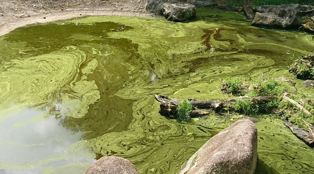
Synthetic fertilizer running off into streams can cause headwaters to have unnaturally high concentrations of certain nutrients, such as nitrogen. This results in excessive growth of algae, creating algal blooms, and using up the dissolved oxygen in the stream, harming fish and other stream organisms.
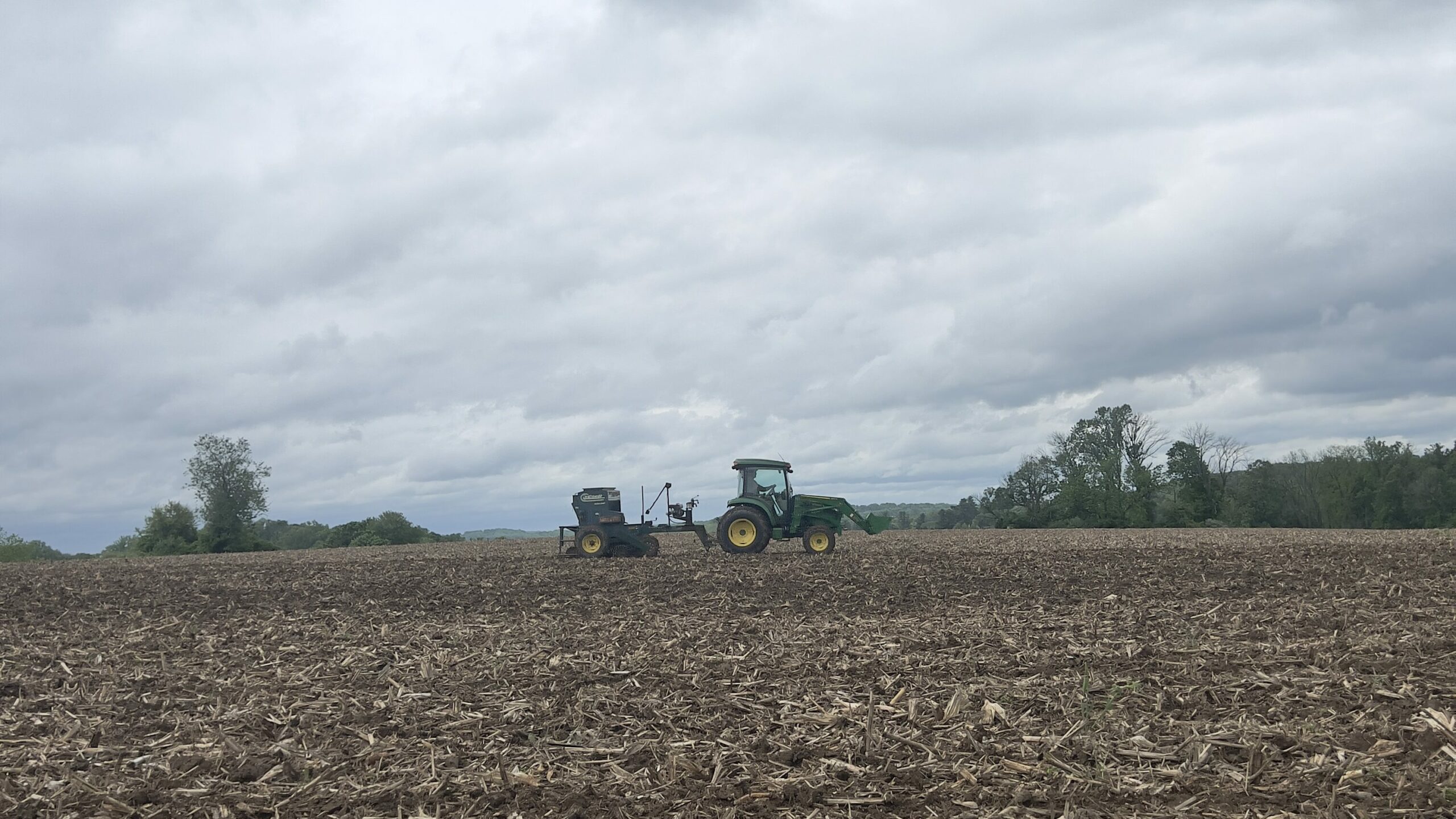
Healthy soil is crucial for maintaining a healthy freshwater ecosystem. In just one teaspoon of healthy soils, there are more microbes than people on the planet!2 These microbes have a mutually beneficial relationship with plants. Plants provide the microorganisms with a place to live and in turn, the microbes give the plants the nutrients they need to survive. However, these communities are depleted through excess use of synthetic fertilizers. Man-made fertilizers such as phosphate, nitrogen, and potassium sulfate focus on feeding the plant while organic fertilizers such as manure or compost focus on fostering healthy soil communities. As more and more synthetic fertilizers are applied to the land, microbe communities stop their mutualistic relationship with the plants. The plants no longer need the nutrients microbes provide as they are receiving them directly from synthetic fertilizers, so the microbial communities start to disappear.
Not only do these microscopic communities feed plants, but they are also imperative for maintaining a good soil structure. Their presence in soil prevents the ground from becoming too compacted, keeping the soil porous, and allowing water to seep through. In areas of healthy soil, runoff from big rain events is lessened because the water can percolate into the Earth, rather than rushing over it. Without microbial communities, runoff will wash away the topsoil, a necessary component for plant health. Topsoil is nutrient dense and provides plants with a good place for seed germination and rooting. It also filters water and is home to most of the microbes in the soil. As microbial communities are depleted, a positive feedback loop is created. The fewer microorganisms that are in the soil, the more the soil is eroded and more topsoil is washed away. The less topsoil there is, the fewer places microbes have to live. And the fewer microbes there are, the more impervious the soil becomes, causing more runoff and in turn, greater erosion and sedimentation of local stream systems. As it’s washed off the land, topsoil is deposited in nearby waters, bringing excess nutrients with it, greatly depleting the health of the stream.
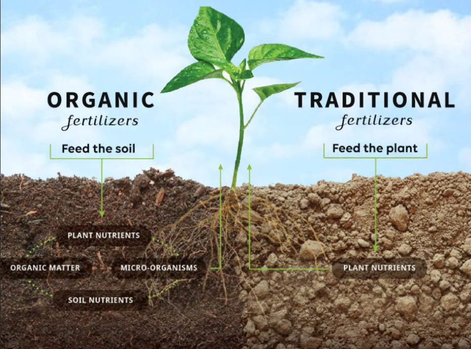
Organic fertilizers feed the soil, fostering a healthy soil microbiome which provides nutrients to plants while upholding soil structure. Traditional or synthetic fertilizers provide those nutrients to the plants directly, leading to the depletion of microbe communities and destabilizing the soil structure.
Soil health is directly tied to the health of freshwater habitats, making it simple for you to do your part in protecting these delicate ecosystems! Limit the amount of synthetic fertilizers you put on your lawn and garden to foster healthy soil and prevent runoff of chemicals into your local waters. When thinking about what to plant on your property, look into plants that like moist soils and will help slow runoff and erosion. The fish will thank you!