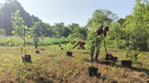
The most important part of a tree planting usually comes after the trees are in the ground. Recently planted trees can not be left unattended or else they will be out-competed by invasive plants or eaten by deer. Consistent tree maintenance is crucial to the survival of a young tree until it can get established in its new environment. For a tree planting in a rural setting, like the recent planting at Ashbridge Lake, maintenance includes weeding, mowing, pruning, and replacing tree tubes to keep deer from damaging the trees. Performing all of this maintenance on a tree planting with close to 1,000 trees can get complicated. Fortunately, we can use technology like a geographic information system (GIS) to help us organize tree maintenance and keep track of every tree on a site.
Over this past summer the Watershed Protection Team did exactly that. Using software from ArcGIS, our team mapped every tree that was planted over the last two years at the Ashbridge Lake site in Ashbridge Preserve. That is a total of 691 trees with a few hundred more set to be planted sometime in 2021. We collected the latitude and longitude of every tree and recorded the species, size, health, and date each tree was planted. We also recorded the last time each tree was maintained. All of this data was compiled and each tree was represented with a point to create the maps shown below.
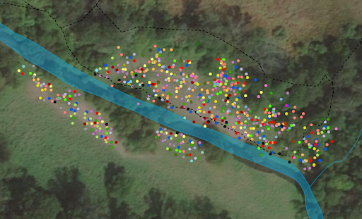
Trees planted at Ashbridge Lake on both banks of Ridley Creek and along the Ridley Creek Loop trail. Each color represents one of the 29 different species planted. 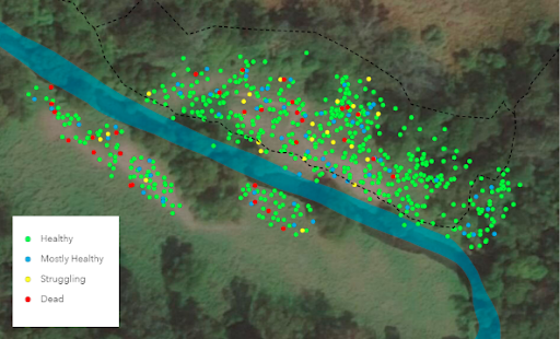
The health of each tree was broken down into four different categories.
In addition to creating a visualization of all of the trees planted along Ridley Creek these maps create a database of information on all of our trees. Keeping track of when each tree was last maintained will help us create a streamlined maintenance system. Data on health helps us monitor the success of the tree planting and look for any unresolved problems in the planting site like areas with poor soil or frequent flooding. Measuring the size of each tree will allow us to look at growth rates to see which species are best suited for our site. All of this information is very valuable when planning for the next stage of planting at this site or for scoping out other sites that need to be reforested.
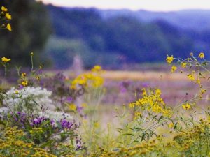
The goal of the tree planting at Ashbridge Lake is to restore the riparian buffer along the creek which will provide habitat and food for native wildlife while improving the water quality of the stream. To achieve these goals it is necessary that as many trees as possible reach full maturity. Creating a tree map to help organize a maintenance plan and collect detailed information on each tree is one tool we can use to assure our tree planting reaches its fullest potential as soon as possible.
This tree planting was made possible by generous funding provided by the Pennsylvania Department of Conservation and Natural Resources and TreeVitalize. See below for the full interactive map and list of species.
EVAN HUNT joined the team as a Conservation Associate in January. Evan Hunt is a native of southeastern Pennsylvania and graduated from Ursinus College in 2018 with a BA in Environmental Studies. Since then, he has worked on a number of riparian buffer restoration projects and become well-versed in native plant identification.